Home › Maharashtra › Mumbai
Other Popular Monsoon Treks in Maharashtra
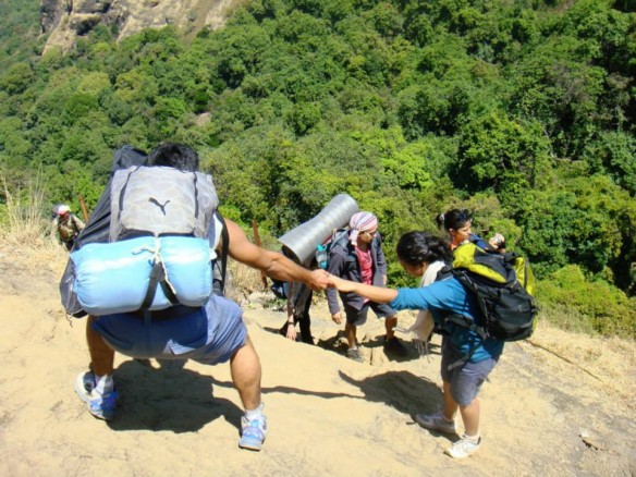
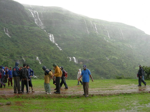
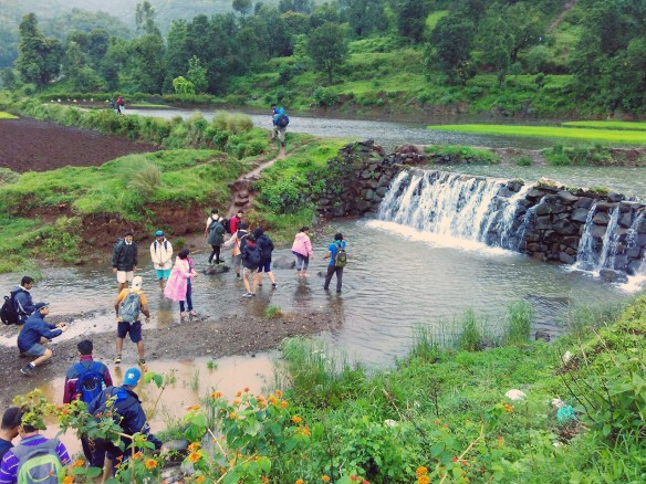
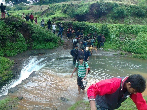
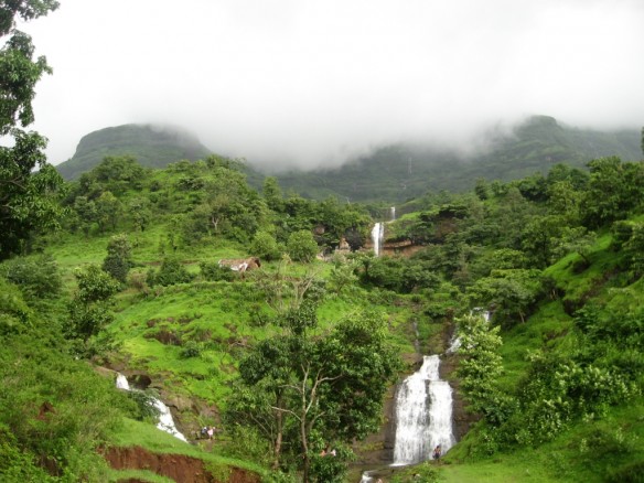

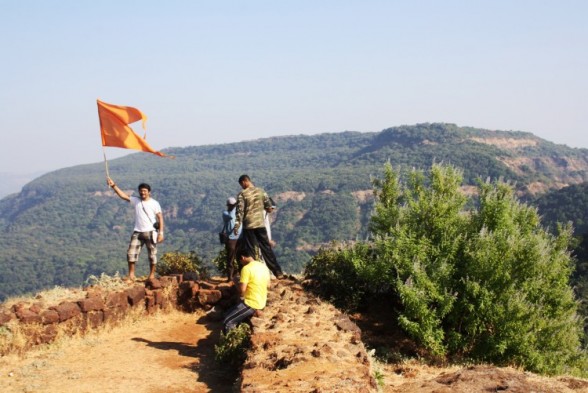
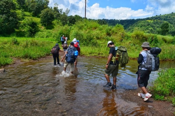
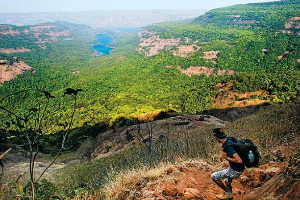
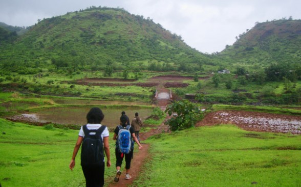
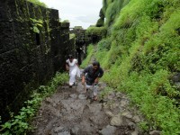
Other Popular Monsoon Treks in MaharashtraDetailed DescriptionEvery year monsoons brings an amazing natural beauty to the western ghats of Maharashtra.During this time the entire Sahaydri range turns into a trekkers paradise with some beautiful locations like green hills and valleys, lakes, waterfalls, and some adventurous cliffs to explore.
The Sahyadri, with their rugged topography, rocky mountains and pinnacles, historic hill forts, huge lakes and extensive forest region are a virtual paradise for trekking, climbing and camping. The Sahyadris provide a wide choice of outdoor and adventure to all lovers of outdoor life – the trekker, the climber and the nature lover.
Below are the other popular monsoon treks near Mumbai and Pune that will surely bring out the adventurer in you.
Rajgad Fort Trek
Location: Near Karjat
What to see at the fort: -Sanjeevani Machee
A brief history : Rajgad means 'The King of Forts' and is considered as one of the most important forts in Maharashtra as far as the cultural heritage of the state is concerned. The Rajgad fort as an interesting history and was home to Shivaji for over 25 years till he became the Chhatrapati. Post coronation he shifted his capital to Raigad. But the fort has witnessed lots of historic events, including the birth of Shivaji’s son Rajaram, the death of Shivaji’s Queen Saibai, the return of Shivaji from Agra, the burial of Afzal Khan’s head in theMaha darwaja walls of Balekilla and many more historic wars and events.
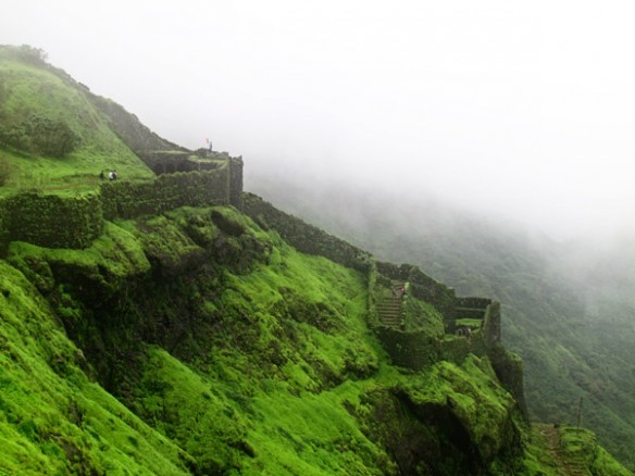
Rajgad is amongst the most popular trekking destinations near Pune. A majestic fort of Rajgad, offers a panoramic view of the surroundings and the best time to visit the Rajgad fort is just after monsoons, however one would find trekkers at Rajgad fort on weekends all throughout the year.
There are 3 ways to reach the top of the fort
Via Gunjawane Route: This trek starts from Gunjawane village and this route takes one through the Chor - Darwaza. This route is slightly difficult as compared to Pali route.
Via Bhor Route: After reaching Bhor, trekkers should move towards Bhutonde village and start their trek. This route is shorter than the other routes (Pali & Gunjawane) mentioned, but is not very popular with trekkers as it is very slippery during monsoon season. But during winters trekkers can try this route as it offers a different experience.
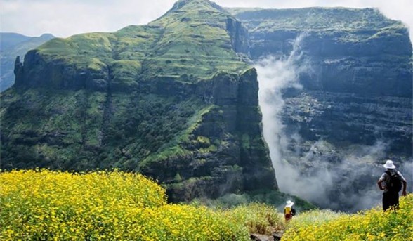
Once at the top of the fort, the beauty of the fort and the surroundings is mesmerizing. The sunrise from Balekilla is a must watch. The fort offers magnificent views of the lush green Sahyadri range. During the month of October the entire area is covered with colorful wild flowers combined with clear blue sky and the splendor of the fort is captivating.
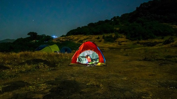
Camping Info
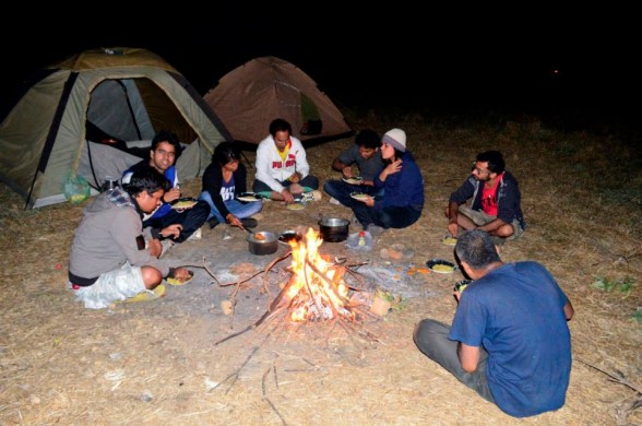
Camping here is ideal during winter and it is always advisable to carry your own camping gear or hire one. Trekkers can also take shelter at the Padmavati temple with can accommodate at least 30 people at night and there is water available at the top of the fort all round the year. But do carry sufficient food in case you are camping overnight.
Recently the local authorities have set up guest rooms on the top of the fort but kindly enquire about their availability incase you plan to stay overnight at the fort. Furthermore, unlike other forts you do not need to carry or search for fire wood as the local villagers sell fire food at cheap rates and are sufficient for the night.
How to reach
From Pune - >
There are several S.T (State Transport) buses are available from Swargate to village Gunjawane. Trekkers can also board buses for Velha and get down at Gunjawane Phata, from here they can take share rickshaws or other local transport to the base village.
If you travelling by private vehicle then take the Pune - Satara road route and reach Nasrapur Phata from there a road leads you to Gunjawane village.
From Mumbai - >
Shivneri Fort Trek
Location: Near Junnar
What to see at the fort - Temple of goddess Shivai after whom Shivaji Maharaj was named
Entry is free to the fort and the timings are: 6:00 a.m. to 5:00 p.m.
A brief history : The fort of Shivneri is one of the historically important forts of Maharashtra as it was the birth place of Shivaji Maharaj who spent the major part of his childhood here. There is a temple of goddess Shivai in the close vicinity of the fort and Shivaji was named after the goddess. Shivaji left the fort in the year1632 and it was soon taken over by the Mughals in 1637.For regional dominance the fort was witness to many tussles between the Mughals and the Marathas only to fall later in the hand of the Peshwas.
Trekking Shivneri fort is fairly easy, and there are 2 options for trekkers, one is to trek all the way to the top from the base village, and second take the motor able road half way to the top and start the trek from there. After that there is a series of stairs (400 steps) that lead to the top.
The ascending paths will take trekkers to a series of 7 gateways Maha Darwaja, Ganesh Darwaja, Pir Darwaja, Hatti Darwaja, Shivai Darwaja, Mena Darwaja and Kulup Darwaja that once safeguarded the fort. On the way trekkers will notice a lot of restoration work on the fort in progress, there are informative signs for trekkers and beautification is in full swing to bring it back to its past glory.
During monsoons the Gulmohar trees here are in full bloom and while trekking one will get breathtaking views as they ascend the fort. Once at the top, trekkers will be rewarded with picturesque views of the surrounding valleys and can explore the historic attractions within the fort.
Trekkers can also explore nearby attractions like the Lenyadri Buddhist caves, Girijatmaj Ashtavinayak Ganesh Mandir, which is about 8 km away. Malshej Ghat is well known for its monsoon scenery is also close by and trekkers can club this spot during their visit to the Shivneri fort.
Camping info Depending on the local authorities and season, camping may or may not be allowed at the Shivneri fort. But there are plenty of caves where trekkers can take shelter at night, but it is always advisable to take your own or hire camping equipment. Trekkers must carry sufficient food and water as there are no proper facilities at the fort or in the nearby areas.
Trekkers can also opt for overnight camping at the Malshej Ghat which is a few km away from Shivneri Fort.
How to reach From Mumbai - > The sleepy town of Junnar is at a distance of 2 km from the Shivneri Fort. Trekkers can reach Junnar from Mumbai or Kalyan via Malshej Ghat or Khandala Ghat.Though the route through Malshej Ghat is preferred as it takes lesser time. Trekkers using public transport can board S.T buses from Kalyan as there are several buses plying between Kalyan and Junnar.While private vehicles can reach Junnar via Malshej Ghat.
From Pune - > From Pune or Shivaji Nagar one can take S.T buses for Junnar. Buses ply on an hourly for Junnar from these bus stands.Distance between Junnar Bus stand and Shivneri base village is 2 km by road.
Pratapgad Fort Trek
Location: Near Mahableshwar / Satara district
What to see at the fort -Entrance of Bale - Killa
Timing: 08:00 a.m. to 05:00 p.m. (Plan your visit well ahead of closing time).
Trekkers interested in history of the fort must keep at least 2 hours aside for exploring the fort.
A brief history : Pratapgad fort was built by Shivaji Maharaj during mid 16th century in order to defend the banks of Nira and Koyna River as they were major trade route during that time.But the real reason for the forts popularity was for its famous tussle between Afzal Khan and Shivaji Maharaj, in which Afzal Khan lost his life. During the 18th century it wasin control of the British Empire and continued to be the center of regional politics. In present times it remains the only fort of Maharashtra which is privately owned bysomeone (Uday Raje Bhosale), the heir of the princely state of Satara.
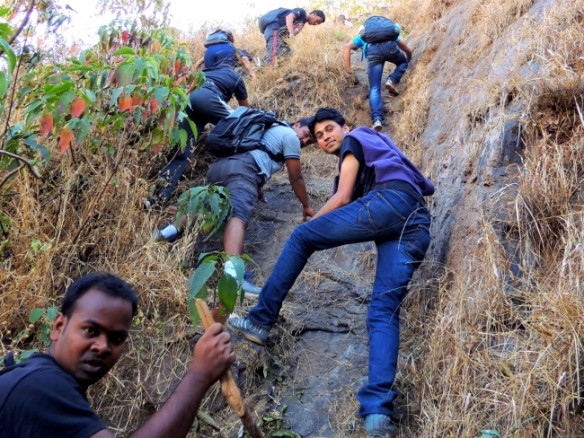
Pratapgad fort is not very popular with experienced trekkers but is ideal for first time trekkers who want to get used to trekking forts. There is no specific trekking trail between the woods instead there is a series of 450 plus steps from the base of the fort to the top. Trekking here during the monsoon is ideal as one will get a glimpse of several waterfalls on the way and adds to the beauty of the place. Once trekkers reach the top they fill find well preserved fortifications, historic monuments and 360 degree panoramic views of the valley.
Camping Info
There is plenty of space for camping at the top of the fort, but it is advisable to carry your own camping equipments including tents.
Though there is a temple at the top of the fort, where trekkers can spend the night camping, but during weekends it gets crowded, and there is not much space for sleeping within the temple premises.
How to reach
Trekkers can club their visit to Pratapgad Fort with a trip to Mahableshwar.
By Road: Mahabaleshwar can be easily reached from both Mumbai and Pune as there are regular buses and cabs to Mahabaleshwar throughout the day.
After reaching Mahableshwar trekkers can board an S.T. bus or hire a private cab to reach Pratapgad fort which is 20 km away.
Ratangad Fort
Location: Ratanwadi / Akole Taluka / Ahmednagar
What to see at the fort
-A small Ganesh temple within a cave.
A brief history : The Ratangad fort is believed to be about 2000 years old. It was initially having a number of naturally formed caves, but gradually over the centuries, its inhabitants built the fort around the natural rock structures. The fort has a rock peak, with a cavity in it at the top, which is called 'Nedhe' or 'Eye of the Needle'.
In recent history the fort was captured by Shivaji Maharaj and it is believed that it was one of his favorite forts because of the natural scenic beauty surrounding the fort. The base village Ratanwadi also has historic importance as it is home to the Amruteshwar temple whose origins can be traced back to Hemandpant era of the 8th century. The fort is also said to be the origin of the Pravara River and the Bhandardara dam has been built on this river.
The Ratangad fort trek is a fairly simple trek, which passes through small fields and thick forests by the Pravara River. The trek is divided into 3 stages; each stage is separated by small plateaus. Towards the end of the trek there are 2 iron ladders one after another, which takes trekkers to the top of the fort. For trekkers trekking Ratangad for the first time it is advisable to hire a guide from the base village (Ratanwadi) as during the rainy season the terrain can be confusing and also the actual fort may not be visible due to the presence of dense fog from the base village.
Camping Info
Ratangad is a great location for camping. There are a number of caves at the fort and are spacious, there is a cave at the summit which is big enough to accommodate about 20 people and has an iron grill which can be closed at night for safety atop the fort, although carrying your own tent would always be advisable. During weekends the villagers do set up small stalls and serve 'Pitla Bhakri' and tea but do not bank on it and carry enough water and food. Trekkers can also opt to camp near Bhandardara Lake or stay there as the place has some good staying options.
How to reach
Route from Mumbai to Ratangad fort By Private Vehicle (Car/Cab)
By Public Transport (Bus / Train)
From Mumbai there are trains available to Igatpuri, from Mumbai to Igatpuri is around 121 kilometers, and then follow the same route from Igatpuri as mentioned above.
Route from Pune to Ratangad fort By Private Vehicle (Car/Cab)
By Public Transport (Bus / Train)
From Pune junction there are trains available to Ahmednagar, from Ahmednagar there are ST (State Transport) buses and local transport available to Rajuri, and then follow the same route from Rajuri mentioned above.
Kalsubai Peak Trek
Location: Akole Taluka / Igatpuri / Ahmednagar
What to see at the fort:
-Kalsubai temple at the summit
A brief history: Kalsubai, according to local legend, was the name of a tormented daughter-in-law who ran away to the top of a hill to escape harassment from her in-laws. She is believed to have disappeared here and the locals built a temple in her memory on the peak’s summit. The hill is named Kalsubai after her.
Kalsubai is the highest peak in Maharashtra and is one of the most enjoyable treks. The route to the top is well marked and many trekkers and pilgrims visit to reach the peak which has a small temple of Kalsubai. During monsoon the peak is like being in heaven and is covered with fog and has strong winds blowing. But the best time to visit is during September just after monsoon when there are thousands of wild flowers blooming everywhere and the climate is just perfect for a trek.
Kalsubai trek has three ladders which have been installed by locals to make the trekking route till Mount Kalsubai easy. When trekkers reach the carved steps and later ladder from Bari Village you would have covered 1/3rd of the trek. After all the ladders are over 2/3rd of the trek is over. After a decent walk on plateau you will reach the final ladder till Kalsubai summit. Trekking Kalsubai peak takes about 3 hours and can be very tiring hence carry enough food and water. Trekkers can also take a night trek in winter and enjoy the sunrise at Kalsubai.
Camping info: Camping in and around Kalsubai is possible and campers can bring in their own tents and rations for the night. However the best option for camping would be by the Arthur Lake near Bhandardara. Bari the base village is less than half an hour from Bhandardara with the rugged Sahyadri hills providing the perfect backdrop for the tranquil lake.
How to reach:
From Mumbai -> It takes about 3 hours to reach Kalsubai from Mumbai by road. Hence it is advisable to take the road route rather than the train from convenience point of view.
If you’re planning to make an overnight journey then plan your stay at Bhandardara which is about 20 km from the base village of Bari. Nature enthusiasts can also camp at the banks of Bhandardara Lake.
Best route from Mumbai to Kalsubai: Mumbai –> Kalyan –> Asangao –> Sakurli –> Ghatgar –> Bhandardara –> Bari –> Kalsubai.
Alternate route: Mumbai –> Kalyan –> Asangaon –> Khardi –> Igatpuri –> Ghoti –> Bari –> Kalsubai.
From Pune : Pune -> Nasik Phata -> Narayangao -> Otur -> Bhramanwada -> Kotul -> Rajur -> Bhandardara - >Bari -> Kalsubai
There are several S.T(State Transport) buses plying between Pune and Bhandardara. From Bhandardara trekkers can hire local transport and reach Bari the base village for the Kalsubai trek.
Jungli Jaigad Trek
- Location: Near Koyna Lake / Koyna Nagar
What to see at the fort: - Natural beauty surrounding the fort (Koyna Wildlife Sanctuary)
There are several forts named Jaigad in Maharashtra. Jungli Jaigad is one of the forts of Jaigad that is surrounded by thick vegetation hence earning its name.Jangli Jaigad is one of the most interesting jungle treks where trekkers will get a chance to see a real dense forest. This forest is part of Koyna Wildlife Sanctuary which is now part of Sahyadri Tiger Reserve. The forest around this fort acts like a wildlife corridor between Koyna and Chandoli forest.
Jangli Jaigad as a fort doesn't have much attractions but its location is extremely beautiful. Once at the top trekkers will get excellent view of the dense jungle, Koyna dam back waters, Kumbharli Ghat and the water body created by discharge of Koyna hydro electricity project stage 4 discharge.
Since the fort is surrounded by thick forest, it houses many wild animals and migratory birds, and if trekkers are lucky they may spot some of these animals during trek.
Camping info: Jungli Jaigad is not ideal for camping due to presence of wild animals and poisonous creatures like snakes and scorpions.
How to reach: From Mumbai
Reach Karad from Mumbai by bus or train, then from Karad board a bus for Chiplun and alight at Koynanagar, from Koynanagar move towards Navja village which is 11 km away.
From Pune by road Pune - > Koynanagar - > Navja village.
Harishchandragad Fort Trek
Location: Malshej Ghat / Ahmednagar
What to see at the fort:
-Kedareshwar Caves
A brief history: The Harihchandragad fort is an ancient fort with its origins dating back to the 6th century. The caves situated at the fort have ancient temples and carvings of deities which suggest that the fort belongs to the medieval period. According to recent history the fort was in control of the Mughal Empire during the 17th century and was later in control of the British Empire.
Harishchandragad is a beautiful hill fort and a popular trekking destination. The trek here is difficult and long and is not recommended for summers. The best season for Harishchandragad trek is just after monsoons and winters. The most popular base for Harishchandragad trek is the Khireshwar village. From Khireshwar Harishchandragad trek is about 9 Km long. The trek route to Harishchandragad is via Junnar Darwaza and Tolar Khind. Enroute the Harishchandragad trek one would cross seven hills each offer magnificent views.
The most fascinating spot in Harishchandragad fort is the Konkan Kada. One can have a breathtaking view of the surrounding region from here. Taramati peak is another spot for panoramic view of the valleys and is the second highest peak in Maharashtra. There are a few ancient caves and temples at Harishchandragad fort. The temple of Harishchandreshwar and Kedareshwar Cave is worth a visit.
Routes:
There are 3 trekking routes to the fort. One via Khireshwar village, via Nalichi Vaat(This is extremely difficult), via Pachnai village(This is the easiest route).
Camping info:
There are several caves at the fort which can be used for overnight camping and can accommodate a 100 people. Trekkers can also carry their own tents and sleeping bags.
How to reach: Mumbai to Khireshwar
Mumbai to Pachnai
Pune to Khireshwar
Pune to Pachnai
Vasota Fort Trek
Location: Near Satara
What to see at the fort
- Nageshwar cave with a Mahadev temple inside
A brief history: According to historians the Vasota fort was under the Maratha rule during the 16th century. It was named Vyaghragad(meaning tiger) by Shivaji Maharaj because of its defensive capability. Later it was in control of the Peshwas (Bajirao Peshwe) only to fall in the hands of the British empire during the 18th century who bombarded the fort and destroyed many structures within the fort.
There are 2 forts i.e. old and new, the old Vasota is inaccessible and trekking is carried out only at the new Vasota fort. This is a dream trek for every trekker as it offers a thrilling experience of walking through a dense forest full of wild animals and an opportunity to get close to nature. On the way up trekkers will Get a glimpse of a Hanuman temple, water reservoirs, old dilapidated structures and the Nageshwar cave which is home to the Mahadev temple.
On reaching the half way trekkers will be rewarded with spectacular views of the Shivsagar Lake and the surrounding beauty of the jungle. Trekkers must ensure that they trek in a group and at no point of time should anyone stray away as the jungle is home to a number of wild animals like wild dogs, sloth bears, leopards and even tigers.Trekkers are advised to carry plenty of water and food as the trek to the summit takes about 3 hours and can be tiring.
Please note:
- Since the fort is in the middle of a dense jungle trekkers must take proper precautions during monsoon as the area is full of leeches.
- Fort Vasota comes under Project Tiger hence prior permission has to be taken from the forest department. Trekking clubs and groups generally take care of these permits in case you not associated with any club or group then make arrangements for the permits.
- Reach Bamnoli village by 8:00 a.m. as you will then get enough time to trek and explore the fort and jungle. Leave the fort latest by 03:30 p.m. as it is not safe to descend late at dark.
Camping Info:
Camping at the fort or in its surrounding areas is not permitted by the forest department as it lies under a wild life sanctuary and attracts wild animals at night.
How to reach: From: Mumbai - > Pune - > Satara -> Bamnoli village From: Pune - > Satara -> Bamnoli village
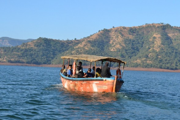
Once at Bamnoli trekkers have to take a boat ride on the Shivsagar Lake for about one and a half hour which will take them to the base of the fort. This is where the actual trek begins.
The boat ride offers breathtaking views of the mountains and sceneries surrounding the lake. Travelling in a large group makes the boat ride cost effective. |
No reviews
Why Book With Us?
 Safe & Secure Payments


 End to End Trip Support