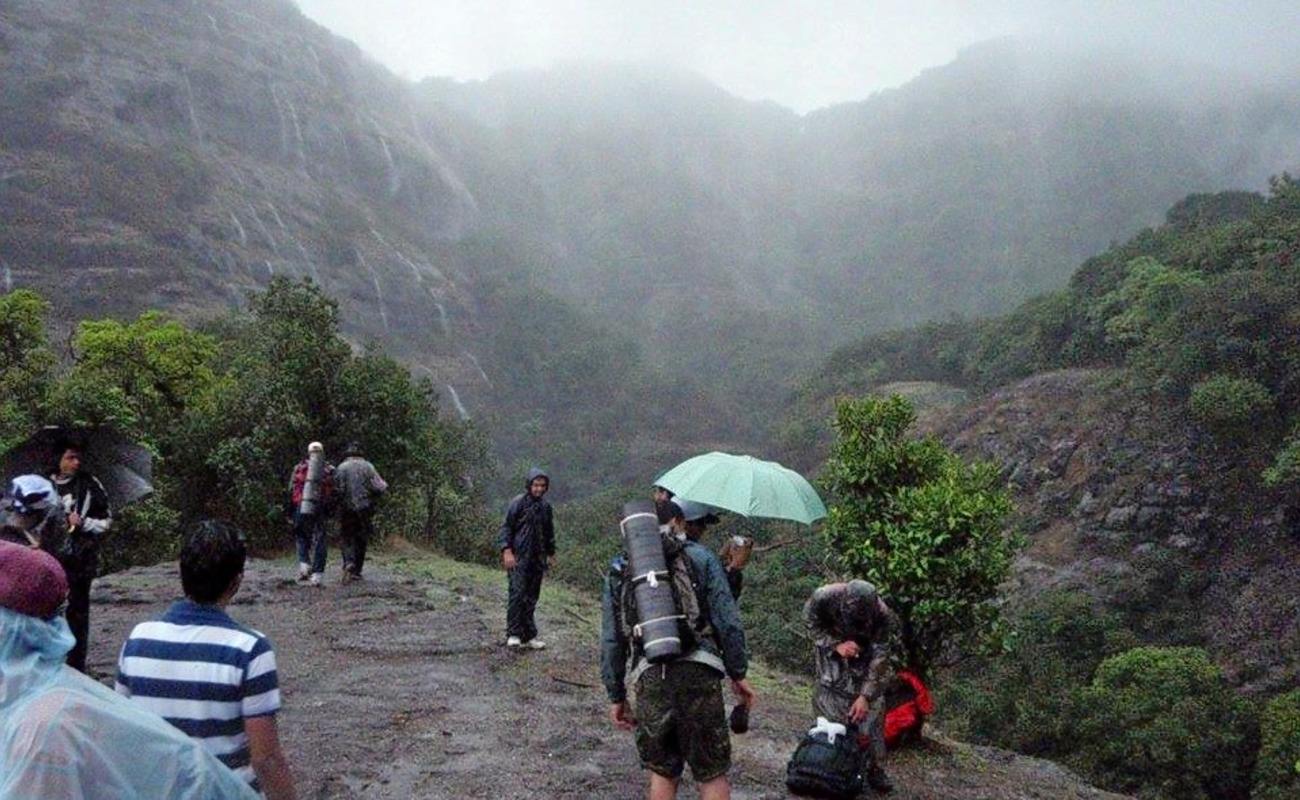
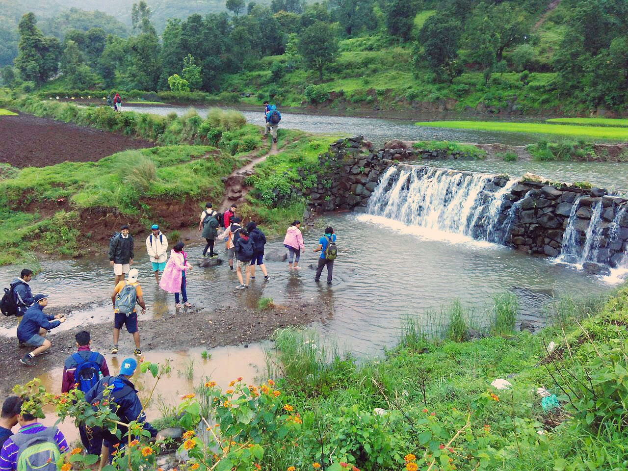
Come monsoon, and Satara turns into a mountain-lovers paradise with its very own valley of flowers and natural waterfalls. Every year, the district of Satara receives very heavy rainfall from July to September. During this time the entire region is covered with lush greenery and waterfalls being the major attraction.
Thoseghar waterfall, is one of the many waterfalls located in this region, and it is believed to be the highest waterfall in Maharashtra, and the third highest in India.
There are a series of waterfalls in this area with some of them being 15 to 20 meters high, while the main Thoseghar waterfall is about 500 meters (1600) feet high.
The waterfall is located, near a picturesque Lake amidst dark woods in a hilly area, and is a calm and quiet place to spend memorable moments in the lap of nature.
Thoseghar is a tiny village that is known for its two waterfalls: the big and the small one.The big Thoseghar waterfall, locally known as Bada Dhabdhaba.
It is about 500 meters (1600) feet high, and can be viewed from a specially made open gallery opposite it. It flows down to a rocky bed, that eventually connects to the nearby larger water bodies such as the Kaas Lake.
The small Thoseghar waterfall is locally known as Chota Dhabdhaba, and is in the opposite direction from the big one.
Please note: During heavy rains tourist must be careful, especially if they are at the base of the waterfall as there have been incidents in the past when tourist have been too adventurous and have lost their lives.
From Satara city, the drive to the Thoseghar village makes one of the most feel good journeys in the Western Ghats. The landscape during monsoon seems to be hand painted in different shades of green.
On a clear day such as this one, you’ll witness rolling hills in every shade of green
Another common sight on the way to Thoseghar, is the numerous windmills that line the hills that run parallel to the Ghats. They make a perfect white spinning crown atop the lush green peaks.
On the way hundreds of Windmills. Its a sight to behold
Best time to visit: July to November is the best time to visit; else the entire region is brown and barren for the most part of the year.
Entry Fee: There is a nominal entry fee to the waterfalls and car parking charges.
Tourist coming by car from Mumbai can reach Pune. From Pune they can continue their journey to Satara and thereon drive down 25 km to the Thoseghar falls.
Tourist coming by public transport can reach Pune. From Pune (Swargate) board a bus to Satara and from there on board a bus or hire a rickshaw to the Thoseghar falls.
Distance from Mumbai to Thoseghar falls: 280 km and takes about 5 hours and 30 minutes.
From Pune –:
Thoseghar waterfalls can be reached using public transport or by car. There are regular buses from Swargate (Pune to Satara) and from Satara tourist can board a bus or hire a rickshaw to the Thoseghar falls.
Distance from Pune to Thoseghar falls: 138 km and takes about 3 hours and 30 minutes.
Where to stay and eat:
Tourist coming from Mumbai and far away areas of Maharashtra can plan an overnight stay in Satara city.There are several hotels, motels and lodges available in all budgets.The city being 25 km from Thoseghar falls serves as an excellent base to explore other attractions near Satara.
Tourist enjoy a cup of tea at Satara
Satara has several restaurants which cater to all kinds of tourist and is an ideal place to have meals.Thoseghar is a small village and has a few small restaurants, eateries and food stalls where tourist can enjoy snacks, tea and coffee.But it is advisable for tourist to keep sufficient eatables/snacks and water during their visit.
Kaas Plateau, also known as Kaas Pathar is a volcanic plateau located near Satara. This 1000 hectare plateau has only recently gained popularity, since it was declared a bio-diversity site by UNESCO in June 2012.
The beautiful flower valley of Maharashtra
Kaas Plateau is Maharashtra’s answer to the Valley of Flowers in Uttarakhand and it comes alive after the rains when the entire region is carpeted with flowers. The plateau is full of wild flowers during the months of August and September and the blooms last for about two to three weeks.
Beautiful flowers blossom everywhere post monsoon
During this time the whole plateau resembles a carpet with flowers of every hue from the color spectrum. There are more than 450 different species of flowers, orchids and carnivorous plants found in Kaas.
A tourist poses amidst numerous flowers in all shapes, sizes and scents.
Due to its beauty, every year the Kaas plateau attracts many tourists, scientists and nature lovers from all over India. The major portion of the Kaas Plateau is a reserve forest and it has received a World Natural Heritage Site too.
Formation of the plateau
The Kaas Plateau was formed by volcanic activities, and is covered by a thin layer of soil; as a result there is no vegetation in this region.
Kaas Plateau is a natural wonder and photographers’ paradise.
Every year during the monsoon season, the Kaas Plateau receives very heavy rainfall as a result, the flora and fauna of the region is unique and endemic. These unique ecological features make Kaas plateau one of the hotspots of biodiversity in Maharashtra.
Bio – diversity
Kaas Plateau is rich in its Bio-diversity and there are more than 850 species of flowering plants that can be found on the plateau.
Carpet of flowers ensconced above a clouded vale.
It is believed that 624 species of plants have entered in the Red Data Book. Out of these 624 species, 39 are found only in Kaas Region. Since the plants here approximate 6% of the Red data species, it has become very important to take effective measures to protect this whole area in order to conserve the diverse, rare and endangered flora of Kaas plateau.
One of the tiny beauties at the Kaas plateau
The plateau changes its colors after every 15 – 20 days, with the monsoon starting from June till October the cycle of flowering plants progresses and changes during these months.
Things to do and see
Take a hike or leisurely walks
A child closely examines a beautiful flower as he explores the landscape
Starting from the end of August to October, this entire plateau seems like a lush green carpet on which beautiful flowers in all colors blossom. This is a magical time and is ideal to spend a few hours unwinding from the hectic city life and taking walks around the plateau and exploring its delights.
Explore the verdant landscape
The Kaas plateau is home to around 850 known species of plants, of which about 600 are of the flowering variety. In addition, many endemic species of plants have also flourished here.
A walk into the beautiful wilderness.
They can only survive in this region, owing to the volcanic rock soil of the plateau. Kaas Plateau’s unique ecosystem also allows around 33 endangered species of plants to thrive here.
These species are only found in rocky lands, and are on the brink of extinction due to the changes in climatic and geological conditions. Amateur biologists and plant lovers can often be seen spending hours, hunched over observing rare plants.
Rest and Rejuvenation by the Lake
Close to the plateau is a moss green Lake called the ‘Kaas Talav’, which usually has a lovely waterfall flowing into it during the peak of monsoon.
A view of the picturesque Kaas Talav
The shore of the lake is flat and sandy and is an ideal place to spend time with friends and family or even pitch a tent for the evening.
Entry Fee: There is a nominal entry fee plus extra charges for parking and camera.
Best time to visit: August and September. Weekends are generally crowded hence only a limited number of people are allowed entry into the Kass plateau and is mostly on first come first served basis.
Tip : Search for hashtag Kaas Plateau on Facebook you will see photos posted by tourist who recently visited Kaas Plateau , this is just to make sure that the flowers are blooming on plateau when you visit.
How to reach
From Mumbai
Travelers can drive down the Mumbai – Pune Expressway and NH4 upto Satara.
From Satara, Kass plateau is about 22 km and the drive up to the valley is quite picturesque.The total distance from Mumbai to Kass plateau is 280 and takes about 5 hours and 30 minutes.
From Pune
A four- lane highway connects Pune and Satara. The 3 hour drive to Satara from Pune can be made easily in one’s own car or in a rented car. There are also buses that ply between Pune and Satara.
From Satara, Kass plateau is about 22 km and drive is pleasant most of the way with the views getting remarkably spectacular near the Kass plateau. The total distance from Pune to Kass plateau is 150 km and takes about 3 hours.
There are no hotel facilities at Kaas Plateau. Some locals do provide home stay facilities in the nearby villages. For proper accommodation can be found in Satara or Mahabaleshwar.
Where to eat
On the Kass plateau, you’re not allowed to carry any food, but before you reach the top, there are a few small food and beverage stalls on the roadsides.
These small eateries offer Maharashtrian fares like Misal Pav and Wada pav etc. Travelers coming from Mumbai and Pune can halt at Satara for a break where they will find restaurants serving all kinds of cuisines. Ideally tourist must carry their own snacks.
Bhandardara is a mini-hill station, nestled in the Sahayadri mountain ranges, and is a lesser known holiday destination near Mumbai and Pune. Bhandardara is full of naturally beautiful sights, and has a peaceful ambiance. It is surrounded by towering hills in the background and lush greenery. During the monsoon and winter season, Bhandardara exudes a colorful symphony, and is home to diverse flora and fauna.
Bhandardara sits by the Pravara River, and according to a local legend, sage Agastya meditated here for a year. Pleased with his penance, the Gods blessed him with a stream of river Ganga, now known as river Pravara. Furthermore there are a number of tourist attractions that awaits travelers like a serene, calming lake, enveloped in the embrace of a dam, waterfalls, forts, valley and much more.
Attractions
Bhandardara Lake (Arthur Lake):
The Bhandardara Lake, also known as the Arthur Lake was created in 1910, when the Wilson dam was built across the Pravara River. The lake is 34 km long and serves as a reservoir for the Wilson Dam.
Bhandardara Lake or Arthur Lake
The lake is situated in the middle of dense green forest and is the most visited tourist spots in Bhandardara and is an ideal place for nature lovers. During sunset the beauty of the place compels travelers to enjoy a pleasant and memorable walk around the lake.
Wilson Dam:
The Wilson dam was built in 1910 across the river Pravara. It is situated at a height of 150 m above sea level and is one of the oldest dams in the country. The opening of the sluice gates creates two 60 to 80 feet cascades of water that plummet to the rocks below. It’s a spectacular view and attracts many tourists.
Tourists can enjoy some quality time in the circular garden located at the base of the dam. The beautiful garden comprises thick greenery, streams and gigantic trees and is home to hundreds of fruit bats. It is one of the most peaceful picnic spots with nature and greenery around.
Randha Waterfall:
One of the major attractions of Bhandardara is the Randha waterfall, which is located at about 11 km down from Wilson dam, and is also a good place to visit during monsoon.
A view of the Randha Waterfalls
The roaring River Pravara descends down from a height of 170 feet into a beautiful gorge and produces hydro-power. The breathtaking view of the waterfalls leaves the visitors spellbound.
Umbrella Falls:
The beautiful falls is visible only when water is released from the Bhandardara(Wilson) dam. Once the gates are opened, the flowing water from the big rock forms a shape of an umbrella, hence called as umbrella falls.
A view of the Umbrella Waterfalls
But this happens only when dam is full and it’s raining continuously. Monsoon is the best time to enjoy the unspoilt beauty of the Umbrella Falls. Due to rain the water level is high and thus, the falls are a treat to watch. The water from the falls is also used for the generation of hydro-electric power.
Trek to the nearby forts and peaks:
Bhandardara provides plenty of opportunity for small treks and hikes for adventure lovers.From Bhandardara, one can climb up to see the Ratangad and Harishchandragad fort.
Trekking in Bhandardara
Or, you can follow the trails that lead to Ajoba and Ghanchakkar peaks. Also, if you are up for a challenge, the highest peak in Maharashtra, Mount Kalsubai (1646 m), stands tall for you to conquer. Standing at the summit, you can have a panoramic view of Sahyadris and Bhandardara.
Amruteshwar Temple:
Bhandardara is also a hot-spot for the religiously inclined, who visit the Amruteshwar Temple an ancient Shiva Temple built during the 11th century and is located in Ratanwadi village.
Amruteshwar Temple
Apart from being a religious place the temple is an interesting place to study and admire the unique architecture and carvings of the temple.
Bookings for a trip to Bhandardara Please CLICK HERE
Things to see and do:
Bhandardara is ideal for all kinds of tourists. If you are an adventure lover there are ample walks to take, sights to explore and peaks to scale. However, for the laid-back tourist, there is the option of cozying up in a chair with a book, or taking a leisurely walk by the lake.
You can also bring your fishing line and tackle along and find a suitable spot for some angling. The lake offers great opportunities for anglers. With just the right combination of patience and luck, you may secure yourself a good catch.
A family enjoys as they explore Bhandardara
There are jeeps and rickshaws available at the village square in Shendi, just 3 km away, to take you on a tour of the predetermined points of interest around Bhandardara.Tourist can also their set your own itinerary and take the hired jeep only to places of their choice.
A travelers plays a guitar at the banks of the lake with the sun setting at the background
The best way to explore Bhandardara’s beauty is to take walks along the shores of the lake. After the first monsoon showers, with the valley shrouded in a green veil and the lake overflowing with water, the views are simply spectacular.
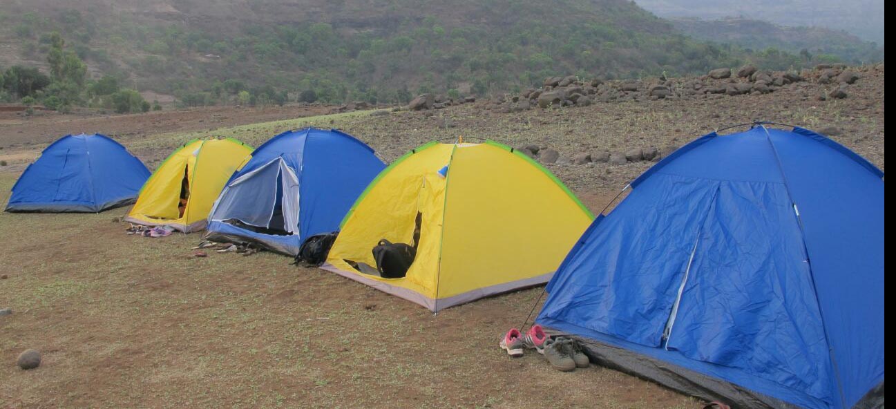
Camping in Bhandardara
Furthermore, there are local guides that usually hang around the MTDC resort, who are willing to show you around for a nominal fee. They are the best choice if you have a car and driver at your disposal and their knowledge of the area is pretty extensive.
Best time to visit:
Best Time: August – February
Monsoon and winter season is the best time to Bhandardara. The place is famous for 3 major attractions dams, waterfalls, and trekking to mount Kalsubai, all are related to water and rains. Winters are extremely cool, but precautions must be taken during summer as the climate is quite hot.
Bookings for a trip to Bhandardara Please CLICK HERE
How to reach Bhandardara from Mumbai:
Bhandardara is located near a small village called ‘Shendi’ in Ahmednagar district and can be reached by road and rail.
By Road : At a road distance of 149 km (Via National Highway 3, State Highway 44) and 163 km (Via National Highway 222), time taken to reach Bhandarda is about 3 to 4 hours depending on your mode of travel i.e. private / rental car or AC buses. Tour operators from Mumbai ply up to Igatpuri station and from there tourist can board an MTDC / S.T. bus or hire a local vehicle like cab / auto. From Igatpuri, Bhandardara is at a distance of 45 km and takes about an hour to reach.
By Railway: Nearest station is Igatpuri which is about 45 kilometers on central railway route. Once you reach the station, follow the MTDC or ST bus as mentioned above to reach Bhandardara.
How to reach Bhandardara from Pune:
By Road: The distance between Pune and Bhandardara is 162 km via NH50. It can be reached in approximately 3.5 to 4 hours. One can opt to drive through NH50. This route involves driving from NH 50 to Narayangaon. After that, one has to take Otur-Ozar Road to NH222, and then drive along MH SH21 and MH SH44. There are 2 more routes that lead to Bhandardara from Pune. One involves driving via Rajya Mahamarga 46 while the other goes via Kopargaon-Shirdi-ahmednagar-Pune Highway.
By Railway: Board a train from Pune to Igatpuri. The total length of this stretch is 133 kilometers by train. After reaching Igatpuri, tourist can hire cabs, taxis or MTDC /S.T buses in order to reach Bhandardara.
Where to stay in Bhandardara:
There are now many hotels and resorts that offer comfortable accommodation at Bhandardara.
MTDC Resort in Bhandardara
Some of the best hotels and resorts are situated around the lake and waterfalls making the stay even more memorable. Budget hotels are also available and there are small lodging located on the outskirts of Bhandardara.
For hotel and resort stays in Bhandardara Please CLICK HERE
Best places to eat in Bhandardara:
There are limited options for eating in Bhandardara. However, there are numerous food stalls offering misal pav and vada pav.Tourist can try out traditional home-cooked food prepared by locals, varan bhat (dal-rice) is easily available but can be spicy.
MTDC offers a multi-cuisine menu and tourist can choose from the vegetarian, non-vegetarian, Chinese and tandoor items on the menu. Recently many new hotels and restaurants have come up in Bhandardara due to the increase in tourism. Bhandardara is also famous for sweet peda which is easily available at every nook and corner.
Location: Near Karjat Distance from Mumbai: 204 km Distance from Pune: 60 km Trekking Duration: 1 day / 2 day / 3 day Trekking Length: Via Pali: 2.5 hours and Via Gunjawane: 3.5 hours Starting point: Gunjawane / Bhor / Pali. (3 base villages) Best season: Monsoon / winter Difficulty: Moderate / Medium Height: 1295 mt (4250 feet) above sea level
The Maha Darwaza en route Balekilla
What to see at the fort:
Sanjeevani Machee
Padmavatee Machee
Padmavati temple
Rameshwaram temple
Alu Darwaza
Pali Darwaza
Suvela Machee
Balekilla (The highest point on the fort)
View of Torna and Sinhagad forts
Chor Darwaza
Gunjavane Darwaza
Ardhchandra Lake
A brief history
Rajgad means ‘The King of Forts’ and is considered as one of the most important forts in Maharashtra as far as the cultural heritage of the state is concerned. The Rajgad fort as an interesting history and was home to Shivaji for over 25 years till he became the Chhatrapati. Post coronation he shifted his capital to Raigad. But the fort has witnessed lots of historic events, including the birth of Shivaji’s son Rajaram, the death of Shivaji’s Queen Saibai, the return of Shivaji from Agra, the burial of Afzal Khan’s head in the Maha darwaja walls of Balekilla and many more historic wars and events.
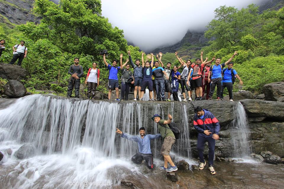
Trekkers make their way up to the fort
Description
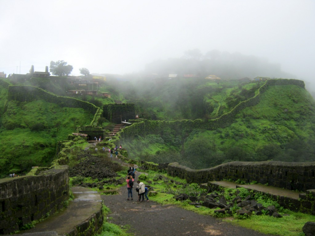
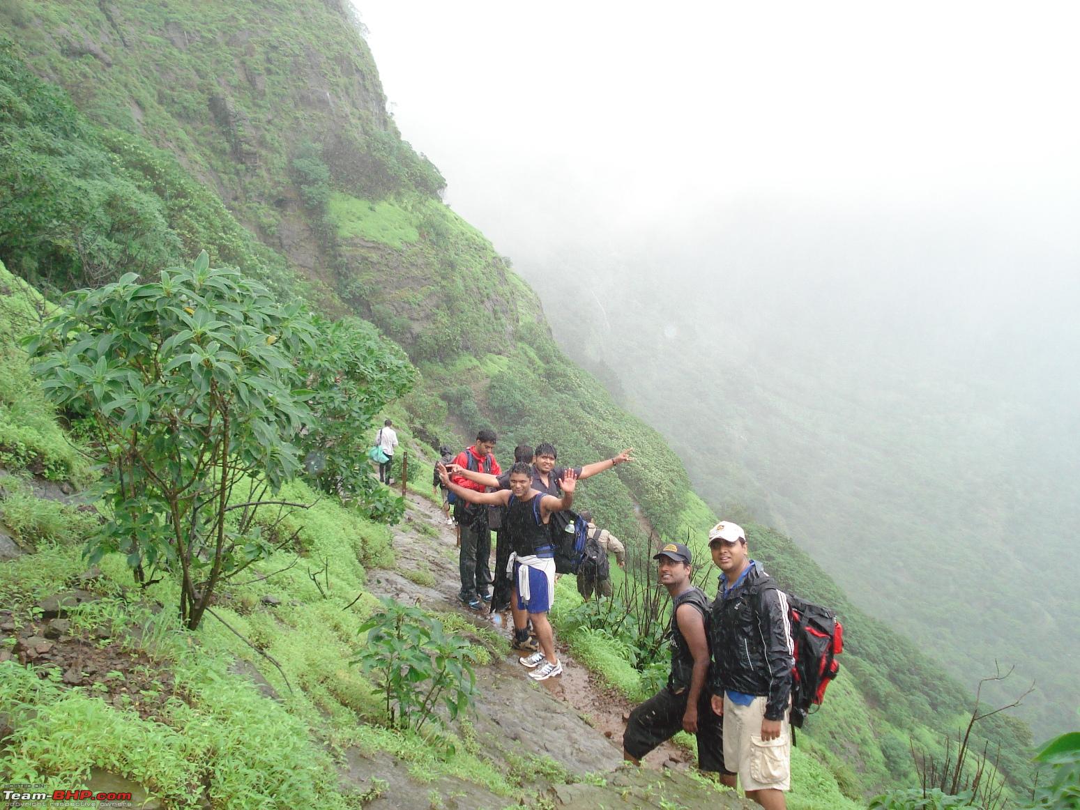
Rajgad is amongst the most popular trekking destinations near Pune. A majestic fort of Rajgad, offers a panoramic view of the surroundings and the best time to visit the Rajgad fort is just after monsoons, however one would find trekkers at Rajgad fort on weekends all throughout the year.
There are 3 ways to reach the top of the fort
Via Pali Route:
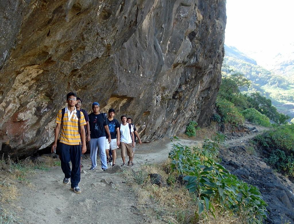
This trek starts from Pali village and this route takes one through the Maha – Darwaza. This route is easy to trek on and ideal for first timers.
Via Gunjawane Route:
This trek starts from Gunjawane village and this route takes one through the Chor – Darwaza. This route is slightly difficult as compared to Pali route.
Via Bhor Route:
After reaching Bhor, trekkers should move towards Bhutonde village and start their trek. This route is shorter than the other routes (Pali & Gunjawane) mentioned, but is not very popular with trekkers as it is very slippery during monsoon season. But during winters trekkers can try this route as it offers a different experience.
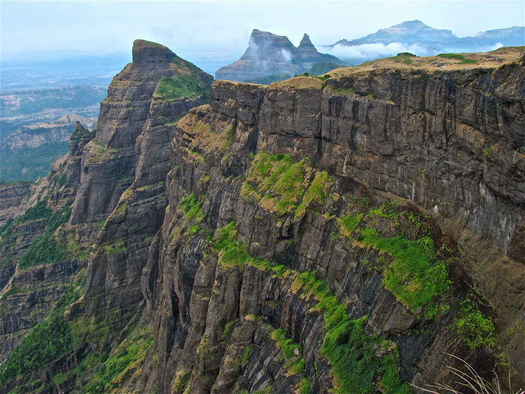
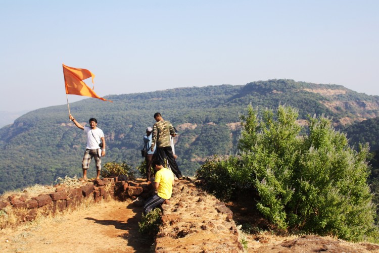
Once at the top of the fort, the beauty of the fort and the surroundings is mesmerizing. The sunrise from Balekilla is a must watch. The fort offers magnificent views of the lush green Sahyadri range. During the month of October the entire area is covered with colorful wild flowers combined with clear blue sky and the splendor of the fort is captivating.
Camping Info
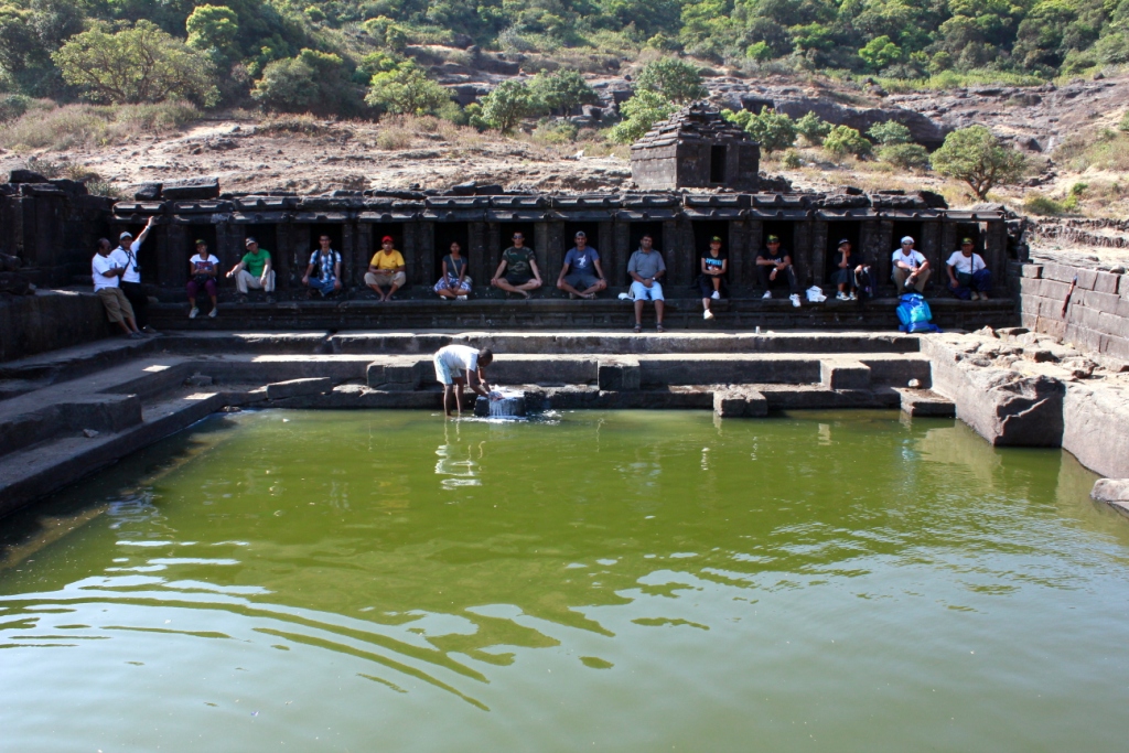
Camping here is ideal during winter and it is always advisable to carry your own camping gear or hire one. Trekkers can also take shelter at the Padmavati temple with can accommodate at least 30 people at night and there is water available at the top of the fort all round the year. But do carry sufficient food in case you are camping overnight.
A Shiv Temple at Padmavati machi where campers can take shelter
Recently the local authorities have set up guest rooms on the top of the fort but kindly enquire about their availability incase you plan to stay overnight at the fort.
Furthermore, unlike other forts you do not need to carry or search for fire wood as the local villagers sell fire food at cheap rates and are sufficient for the night.
How to reach
From Pune – >
Rajgad fort is 60 km from Pune city.
There are several S.T (State Transport) buses are available from Swargate to village Gunjawane. Trekkers can also board buses for Velha and get down at Gunjawane Phata, from here they can take share rickshaws or other local transport to the base village.
If you travelling by private vehicle then take the Pune – Satara road route and reach Nasrapur Phata from there a road leads you to Gunjawane village.
From Mumbai – >
Trekkers can reach Pune and then follow the above mentioned route to reach Rajgad Fort.
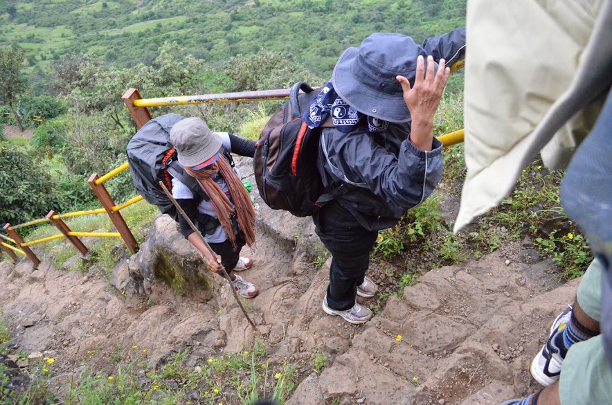
Caution: The roads and trails leading to the fort are quite slippery during Monsoon so be careful while venturing on a trek.For more information read: Precautions to be taken during Monsoon trekking.
Location: Near Junnar Distance from Pune: 125 km Distance from Mumbai: 160 km Trekking Duration: 1 day Trekking Length: 2 hours Starting point: Junnar Best season: Monsoon / winter Difficulty: Medium Height: 1066 (mt) / 3500 (feet) above sea level
What to see at the fort
Temple of goddess Shivai after whom Shivaji Maharaj was named
Kadelkot Point ( execution point from where criminals were thrown)
Ambarkhana (Food storage place used in olden days to store rations)
Water Springs on the fort(Ganga & Jamuna)
Statue of Shivaji Maharaj and Jijabai
Badami Talab( A water reservoir)
7 gateways of the fort
Kamani Masjid
Panoramic views of Junnar from the top
Entry is free to the fort and the timings are: 6:00 a.m. to 5:00 p.m.
The birth place of Shivaji Maharaj
A brief history
The fort of Shivneri is one of the historically important forts of Maharashtra as it was the birth place of Shivaji Maharaj who spent the major part of his childhood here. There is a temple of goddess Shivai in the close vicinity of the fort and Shivaji was named after the goddess. Shivaji left the fort in the year1632 and it was soon taken over by the Mughals in 1637.For regional dominance the fort was witness to many tussles between the Mughals and the Marathas only to fall later in the hand of the Peshwas.
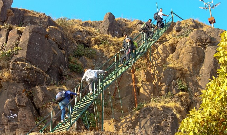
Trekking Shivneri fort is fairly easy, and there are 2 options for trekkers, one is to trek all the way to the top from the base village, and second take the motor able road half way to the top and start the trek from there. After that there is a series of stairs (400 steps) that lead to the top.
One of the grand gateways of the fort
The ascending paths will take trekkers to a series of 7 gateways Maha Darwaja, Ganesh Darwaja, Pir Darwaja, Hatti Darwaja, Shivai Darwaja, Mena Darwaja and Kulup Darwaja that once safeguarded the fort. On the way trekkers will notice a lot of restoration work on the fort in progress, there are informative signs for trekkers and beautification is in full swing to bring it back to its past glory.
During monsoons the Gulmohar trees here are in full bloom and while trekking one will get breathtaking views as they ascend the fort. Once at the top, trekkers will be rewarded with picturesque views of the surrounding valleys and can explore the historic attractions within the fort.
Trekkers can also explore nearby attractions like the Lenyadri Buddhist caves, Girijatmaj Ashtavinayak Ganesh Mandir, which is about 8 km away. Malshej Ghat is well known for its monsoon scenery is also close by and trekkers can club this spot during their visit to the Shivneri fort.
Camping info
Depending on the local authorities and season, camping may or may not be allowed at the Shivneri fort. But there are plenty of caves where trekkers can take shelter at night, but it is always advisable to take your own or hire camping equipment.
Trekkers enjoy camping at the nearby Malshej ghat
Trekkers must carry sufficient food and water as there are no proper facilities at the fort or in the nearby areas.Trekkers can also opt for overnight camping at the Malshej Ghat which is a few km away from Shivneri Fort.
How to reach
From Mumbai – >
The sleepy town of Junnar is at a distance of 2 km from the Shivneri Fort. Trekkers can reach Junnar from Mumbai or Kalyan via Malshej Ghat or Khandala Ghat.Though the route through Malshej Ghat is preferred as it takes lesser time.
Trekkers using public transport can board S.T buses from Kalyan as there are several buses plying between Kalyan and Junnar.While private vehicles can reach Junnar via Malshej Ghat.
From Pune – >
From Pune or Shivaji Nagar one can take S.T buses for Junnar. Buses ply on an hourly for Junnar from these bus stands.Distance between Junnar Bus stand and Shivneri base village is 2 km by road.
Caution: The roads and trails leading to the fort are quite slippery during Monsoon so be careful while venturing on a trek.For more information read: Precautions to be taken during Monsoon trekking.
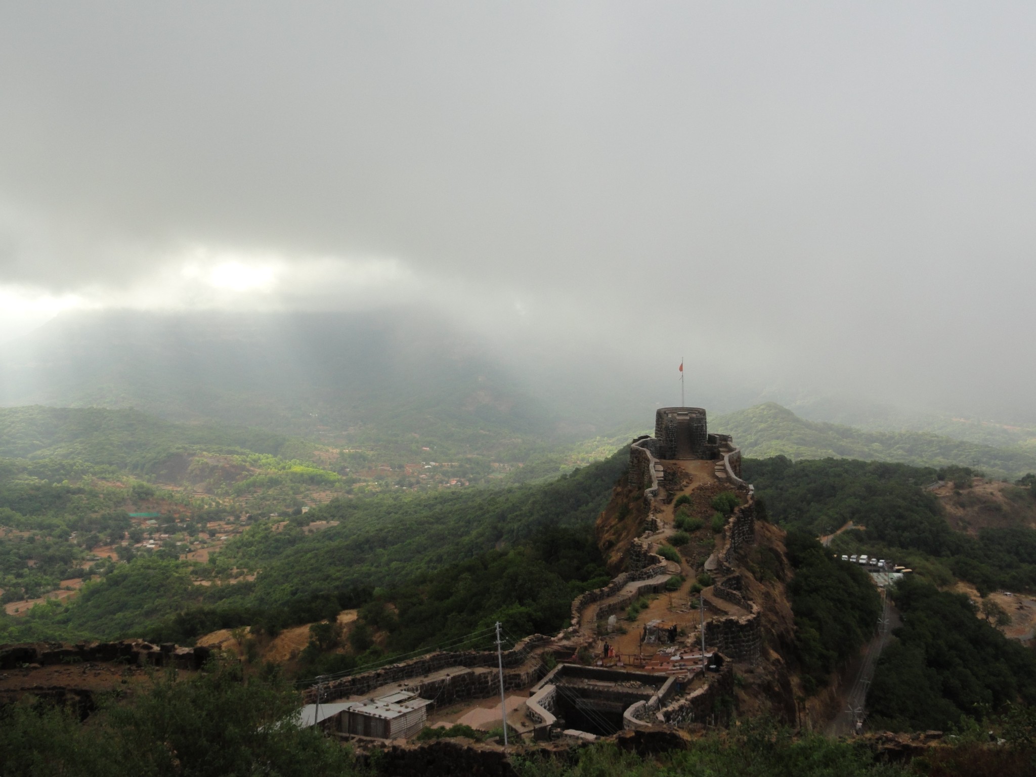
Location: Near Mahableshwar / Satara district Distance from Mumbai: 220 km Distance from Pune: 140 km Distance from Mahableshwar : 20 km Trekking Duration: 1 day / 2 day Trekking Length: 2 hours Starting point: Pratapgad fort parking Best season: All round the year. Monsoon is the ideal time Difficulty: Easy Height: 1080 (mt) / 3545 (feet) above sea level
What to see at the fort
Entrance of Bale – Killa
Watch towers on the fort
Statue of Shivaji Maharaj
Bastions on the fort
Beautiful Sahyadri mountains surrounding the fort
Afzal Khan’s dargah
Bhavani Temple
Afzal Tower
Rahat Lake – Biggest lake on the fort
Heavy Canons at the top
Timing: 08:00 a.m. to 05:00 p.m. (Plan your visit well ahead of closing time).
Trekkers interested in history of the fort must keep at least 2 hours aside for exploring the fort.
A Statue of Shivaji Maharaj at Pratapgad Fort
A brief history
Pratapgad fort was built by Shivaji Maharaj during mid 16th century in order to defend the banks of Nira and Koyna River as they were major trade route during that time. But the real reason for the forts popularity was for its famous tussle between Afzal Khan and Shivaji Maharaj, in which Afzal Khan lost his life. During the 18th century it was in control of the British Empire and continued to be the center of regional politics. In present times it remains the only fort of Maharashtra which is privately owned by someone (Uday Raje Bhosale), the heir of the princely state of Satara.
Trekkers make their way to the top at Pratapgad Fort
Description
Pratapgad fort is not very popular with experienced trekkers but is ideal for first time trekkers who want to get used to trekking forts. There is no specific trekking trail between the woods instead there is a series of 450 plus steps from the base of the fort to the top. Trekking here during the monsoon is ideal as one will get a glimpse of several waterfalls on the way and adds to the beauty of the place. Once trekkers reach the top they fill find well preserved fortifications, historic monuments and 360 degree panoramic views of the valley.
Camping Info
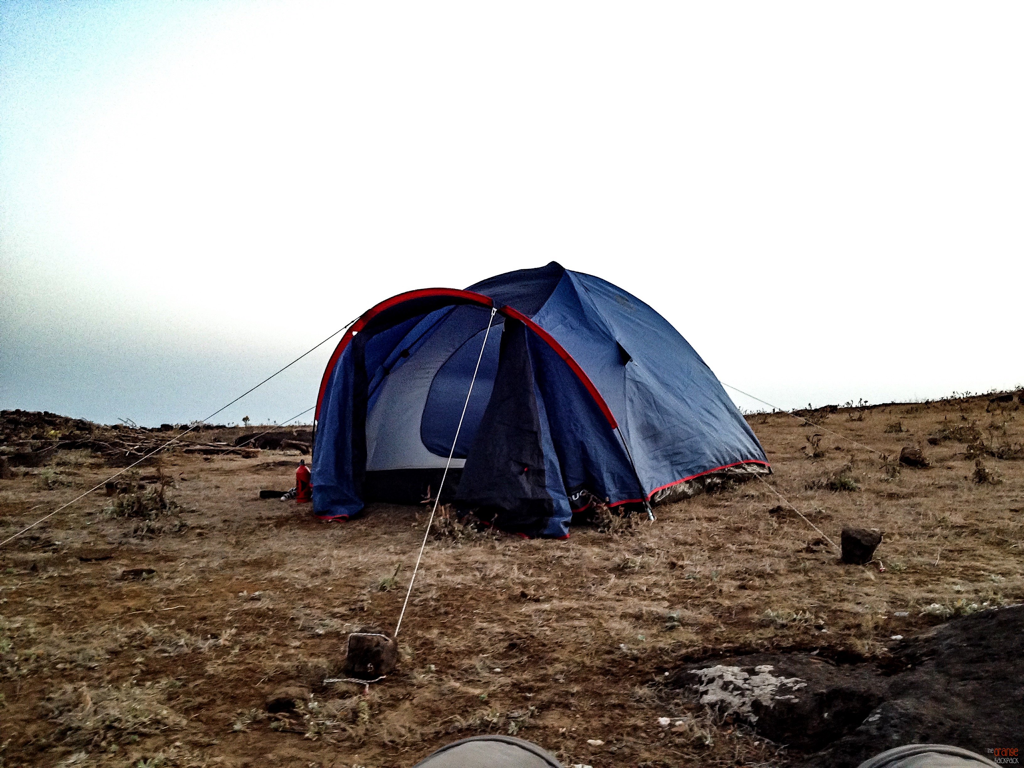
There is plenty of space for camping at the top of the fort, but it is advisable to carry your own camping equipments including tents.
Camping at Pratapgad Fort
Though there is a temple at the top of the fort, where trekkers can spend the night camping, but during weekends it gets crowded, and there is not much space for sleeping within the temple premises.
How to reach
Trekkers can club their visit to Pratapgad Fort with a trip to Mahableshwar.
By Road: Mahabaleshwar can be easily reached from both Mumbai and Pune as there are regular buses and cabs to Mahabaleshwar throughout the day.
After reaching Mahableshwar trekkers can board an S.T. bus or hire a private cab to reach Pratapgad fort which is 20 km away.
Caution: The roads and trails leading to the fort are quite slippery during Monsoon so be careful while venturing on a trek.For more information read: Precautions to be taken during Monsoon trekking.
Location: Ratanwadi / Akole Taluka / Ahmednagar Distance from Pune: 215 km Distance from Mumbai: 180 km Trekking Duration: 1 day Trekking Length: 3 hours to the summit Starting point: Ratanwadi is the base village Best season: Monsoon and winter Difficulty: Easy / Medium Height: 1142 mt (4250 feet) above sea level
What to see at the fort
A small Ganesh temple within a cave.
Big and small caves scattered around the fort
Ruins of Rani Mahal
Pravara river originates in Ratangad
The Amruteshwar Temple at Ratanwadi(base village)
View of the scenic beauty surrounding the fort from the top
The ancient Amruteshwar temple at the base village Ratanwadi
A brief history
The Ratangad fort is believed to be about 2000 years old. It was initially having a number of naturally formed caves, but gradually over the centuries, its inhabitants built the fort around the natural rock structures. The fort has a rock peak, with a cavity in it at the top, which is called ‘Nedhe’ or ‘Eye of the Needle’.
In recent history the fort was captured by Shivaji Maharaj and it is believed that it was one of his favorite forts because of the natural scenic beauty surrounding the fort. The base village Ratanwadi also has historic importance as it is home to the Amruteshwar temple whose origins can be traced back to Hemandpant era of the 8th century. The fort is also said to be the origin of the Pravara River and the Bhandardara dam has been built on this river.
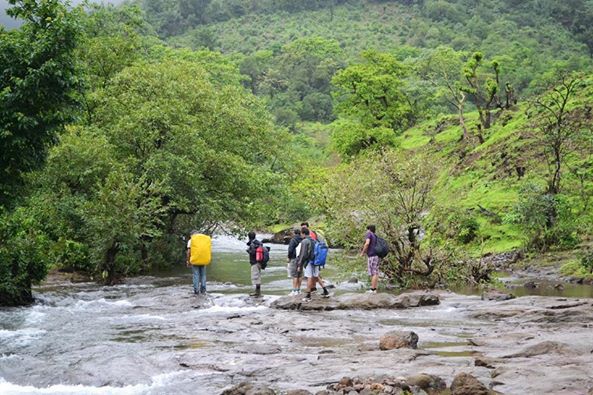
The Ratangad fort trek is a fairly simple trek, which passes through small fields and thick forests by the Pravara River. The trek is divided into 3 stages; each stage is separated by small plateaus. Towards the end of the trek there are 2 iron ladders one after another, which takes trekkers to the top of the fort.
For trekkers trekking Ratangad for the first time it is advisable to hire a guide from the base village (Ratanwadi) as during the rainy season the terrain can be confusing and also the actual fort may not be visible due to the presence of dense fog from the base village.
Camping Info
Ratangad is a great location for camping. There are a number of caves at the fort and are spacious, there is a cave at the summit which is big enough to accommodate about 20 people and has an iron grill which can be closed at night for safety atop the fort, although carrying your own tent would always be advisable.
During weekends the villagers do set up small stalls and serve ‘Pitla Bhakri’ and tea but do not bank on it and carry enough water and food. Trekkers can also opt to camp near Bhandardara Lake or stay there as the place has some good staying options.
How to reach
Route from Mumbai to Ratangad fort
By Private Vehicle (Car/Cab)
Take the following route:
Mumbai – > Thane – > Padgha -> Shahapur -> Khardi -> Kasara -> Igatpuri -> Ghoti -> Bhandardara -> Ratanwadi -> Ratangad fort.
By Public Transport (Bus / Train)
From Mumbai there are ST (State Transport) buses or trains available to Igatpuri, distance between Mumbai to Igatpuri are 121 kilometers, from here there are ST (State Transport) buses and local transport available to Bhandardara or Shendi village, from here on there are local transport available to Ratanwadi village.
From Mumbai there are trains available to Igatpuri, from Mumbai to Igatpuri is around 121 kilometers, and then follow the same route from Igatpuri as mentioned above.
Route from Pune to Ratangad fort
By Private Vehicle (Car/Cab)
Take the following route:
Pune -> Lonikand -> Shikrapur -> Ranjangaon -> Shirur -> Ahmednagar -> Rajuri -> Shendi -> Ratanwadi -> Ratangad fort.
By Public Transport (Bus / Train)
From Pune there are direct ST (State Transport) buses available from Shivajinagar to Rajuri (Ahmednagar), From Rajuri there are local transport are available to reach at Shendi village, from here there are taxi available to reach at Ratanwadi village.
From Pune junction there are trains available to Ahmednagar, from Ahmednagar there are ST (State Transport) buses and local transport available to Rajuri, and then follow the same route from Rajuri mentioned above.
Caution: The roads and trails leading to the fort are quite slippery during Monsoon so be careful while venturing on a trek.For more information read: Precautions to be taken during Monsoon trekking.
Location: Malshej Ghat / Ahmednagar Distance from Mumbai: 210 km Distance from Pune: 165 km Trekking Duration: 1 day / 2 day Trekking Length: 6 hours Starting point: The fort can be reached by 3 routes via Khireshwar / Belpada / Kothale villages. Best season: Monsoon and winters Difficulty: Moderate / Medium Height: 1435 mt (4710 feet) above sea level
What to see at the fort:
Kedareshwar Caves
Konkan Kada
Taramati peak
Views of Naneghat and forts near Murbad
Kedareshwar Temple
Other Caves
Trekkers relax at the caves of Harishchandragad
A brief history:
The Harihchandragad fort is an ancient fort with its origins dating back to the 6th century. The caves situated at the fort have ancient temples and carvings of deities which suggest that the fort belongs to the medieval period. According to recent history the fort was in control of the Mughal Empire during the 17th century and was later in control of the British Empire.
Harishchandragad is a beautiful hill fort and a popular trekking destination. The trek here is difficult and long and is not recommended for summers. The best season for Harishchandragad trek is just after monsoons and winters. The most popular base for Harishchandragad trek is the Khireshwar village. From Khireshwar Harishchandragad trek is about 9 Km long. The trek route to Harishchandragad is via Junnar Darwaza and Tolar Khind. Enroute the Harishchandragad trek one would cross seven hills each offer magnificent views.
The most fascinating spot in Harishchandragad fort is the Konkan Kada. One can have a breathtaking view of the surrounding region from here. Taramati peak is another spot for panoramic view of the valleys and is the second highest peak in Maharashtra. There are a few ancient caves and temples at Harishchandragad fort. The temple of Harishchandreshwar and Kedareshwar Cave is worth a visit.
Routes:
There are 3 trekking routes to the fort. One via Khireshwar village, via Nalichi Vaat(This is extremely difficult), via Pachnai village(This is the easiest route).
The Khireshwar village route is one of the most preferred routes as it offers scenic views while trekking, but this route is a bit time consuming.
An ancient temple of Harishchandragad
Camping info:
There are several caves at the fort which can be used for overnight camping and can accommodate a 100 people. Trekkers can also carry their own tents and sleeping bags.
Trekkers making arrangements for am overnight camp at Harishchandragad fort
Carry plenty of water and food as there is no source of portable water or edible food at the fort or base villages. Collect enough fire wood before night fall as the temperature at night is really low at the top and carry enough warm clothing.
How to reach:
Mumbai to Khireshwar
Mumbai – > Kalyan – > Via NH 222 – > Malshej Ghat – > Khireshwar – > Harishchandragad fort
Mumbai to Pachnai
Mumbai > Ighatpuri > Ghoti -> Bari – > Rajur -> Pachnai village – > Harishchandragad fort
Pune to Khireshwar
Pune -> (NH 50 Nashik Highway) – > Alephata – > Otur – > Khireshwar – > Harishchandragad fort
Pune to Pachnai
Pune – > Alephata – > Sangamner – > Akole -> Rajur -> Pachnai village – > Harishchandragad fort
For bookings for a Monsoon Trek to Harishchandragad Fort PLEASE CLICK HERE
Caution: The roads and trails leading to the fort are quite slippery during Monsoon so be careful while venturing on a trek.For more information read: Precautions to be taken during Monsoon trekking.
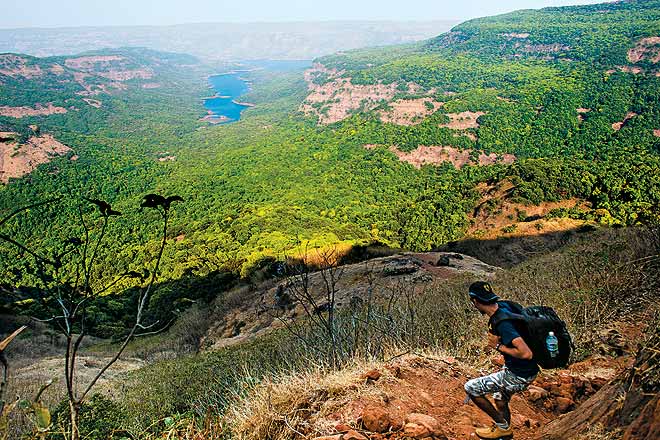
Location: Near Satara Distance from Pune: 250 km Distance from Mumbai: 280 km Trekking Duration: 1 day / 2 day Trekking Length: 3 hours to reach to the summit Starting point: Bamnoli is the base village Best season: All round the year Difficulty: Difficult (Ideal only for regular trekkers) Height: 1171 mt (3842 feet) above sea level
What to see at the fort
Nageshwar cave with a Mahadev temple inside
Views of Babu Kada
Spectacular views of Koyna backwaters and of the Wild Life Sanctuary
Trek through the jungle(wild life reserve)
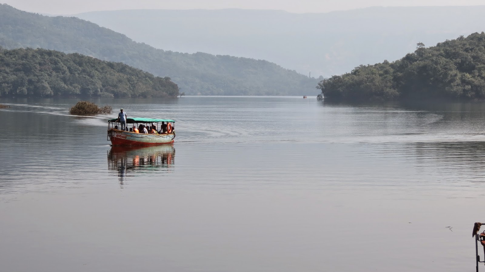
Enjoy a boat ride through the Koyna backwaters
Ideal location for wild life photography
The view from Vasota Fort
A brief history:
According to historians the Vasota fort was under the Maratha rule during the 16th century. It was named Vyaghragad(meaning tiger) by Shivaji Maharaj because of its defensive capability. Later it was in control of the Peshwas (Bajirao Peshwe) only to fall in the hands of the British empire during the 18th century who bombarded the fort and destroyed many structures within the fort.
Trekkers take a boat ride to the base of the Vasota Fort
There are 2 forts i.e. old and new, the old Vasota is inaccessible and trekking is carried out only at the new Vasota fort. This is a dream trek for every trekker as it offers a thrilling experience of walking through a dense forest full of wild animals and an opportunity to get close to nature. On the way up trekkers will Get a glimpse of a Hanuman temple, water reservoirs, old dilapidated structures and the Nageshwar cave which is home to the Mahadev temple.
Trekkers on reaching the base of the Vasota fort after a boat ride
On reaching the half way trekkers will be rewarded with spectacular views of the Shivsagar Lake and the surrounding beauty of the jungle. Trekkers must ensure that they trek in a group and at no point of time should anyone stray away as the jungle is home to a number of wild animals like wild dogs, sloth bears, leopards and even tigers. Trekkers are advised to carry plenty of water and food as the trek to the summit takes about 3 hours and can be tiring.
Trekking through the dense jungles of Vasota fort
Please note:
Since the fort is in the middle of a dense jungle trekkers must take proper precautions during monsoon as the area is full of leeches.
Fort Vasota comes under Project Tiger hence prior permission has to be taken from the forest department. Trekking clubs and groups generally take care of these permits in case you not associated with any club or group then make arrangements for the permits.
Reach Bamnoli village by 8:00 a.m. as you will then get enough time to trek and explore the fort and jungle. Leave the fort latest by 03:30 p.m. as it is not safe to descend late at dark.
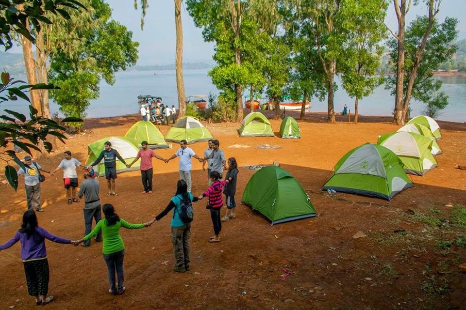
Camping Info:
Camping at the fort or in its surrounding areas is not permitted by the forest department as it lies under a wild life sanctuary and attracts wild animals at night.
Camping by the Lake
Trekkers can enjoy camping at the Bamnoli (base village) and set up a campsite along the beautiful Shivsagar Lake and enjoy its beauty.
How to reach:
From: Mumbai - > Pune – > Satara -> Bamnoli village
From: Pune – > Satara -> Bamnoli village
Once at Bamnoli trekkers have to take a boat ride on the Shivsagar Lake for about one and a half hour which will take them to the base of the fort. This is where the actual trek begins.
The boat ride offers breathtaking views of the mountains and sceneries surrounding the lake. Traveling in a large group makes the boat ride cost effective.
Caution: The roads and trails leading to the fort are quite slippery during Monsoon so be careful while venturing on a trek.For more information read: Precautions to be taken during Monsoon trekking.
Location: Akole Taluka / Igatpuri / Ahmednagar Distance from Pune: 175 km Distance from Mumbai: 160 km Trekking Duration: 1 day Trekking Length: 3 hours to the summit Starting point: Bari Goan is the base village Best season: Monsoon / Winter Difficulty: Moderate / Medium (not for first time trekkers as the way up takes about 3 hrs). Height: 1646 mt (5400 feet) above sea level.
What to see at the fort:
Kalsubai temple at the summit
Highest peak in Maharashtra
View of nearby forts
Being the highest peak it commands beautiful views of surrounding
Get a feel of the clouds touching the mountains
A brief history:
Kalsubai, according to local legend, was the name of a tormented daughter-in-law who ran away to the top of a hill to escape harassment from her in-laws. She is believed to have disappeared here and the locals built a temple in her memory on the peak’s summit. The hill is named Kalsubai after her.
Kalsubai is the highest peak in Maharashtra and is one of the most enjoyable treks. The route to the top is well marked and many trekkers and pilgrims visit to reach the peak which has a small temple of Kalsubai. During monsoon the peak is like being in heaven and is covered with fog and has strong winds blowing. But the best time to visit is during September just after monsoon when there are thousands of wild flowers blooming everywhere and the climate is just perfect for a trek.
Kalsubai trek has three ladders which have been installed by locals to make the trekking route till Mount Kalsubai easy. When trekkers reach the carved steps and later ladder from Bari Village you would have covered 1/3rd of the trek. After all the ladders are over 2/3rd of the trek is over. After a decent walk on plateau you will reach the final ladder till Kalsubai summit. Trekking Kalsubai peak takes about 3 hours and can be very tiring hence carry enough food and water. Trekkers can also take a night trek in winter and enjoy the sunrise at Kalsubai.
Camping info:
Camping in and around Kalsubai is possible and campers can bring in their own tents and rations for the night. However the best option for camping would be by the Arthur Lake near Bhandardara. Bari the base village is less than half an hour from Bhandardara with the rugged Sahyadri hills providing the perfect backdrop for the tranquil lake.
How to reach:
From Mumbai ->
It takes about 3 hours to reach Kalsubai from Mumbai by road. Hence it is advisable to take the road route rather than the train from convenience point of view.
If you’re planning to make an overnight journey then plan your stay at Bhandardara which is about 20 km from the base village of Bari. Nature enthusiasts can also camp at the banks of Bhandardara Lake.
Best route from Mumbai to Kalsubai: Mumbai –> Kalyan –> Asangao –> Sakurli –> Ghatgar –> Bhandardara –> Bari –> Kalsubai.
There are several S.T(State Transport) buses plying between Pune and Bhandardara. From Bhandardara trekkers can hire local transport and reach Bari the base village for the Kalsubai trek.
Caution: The roads and trails leading to the fort are quite slippery during Monsoon so be careful while venturing on a trek.For more information read: Precautions to be taken during Monsoon trekking.
News and Updates in this Blog Section of TripPlatform