Tag Archives: Events in maharashtra

Sandhan Valley Trek

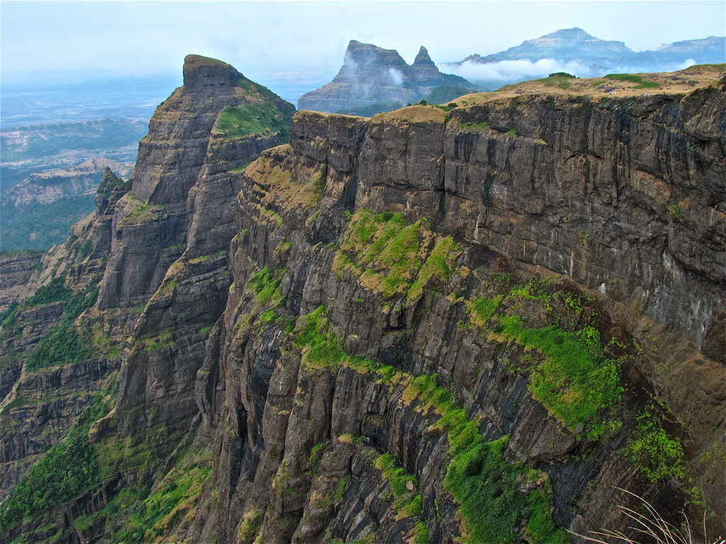
Sandhan valley is a natural wonder, and a hidden gem in the Western Ghats. This water carved valley is a known as the grand canyon of Maharashtra, and is 200 feet deep and 2 km long.

The gorge of Sandhan Valley

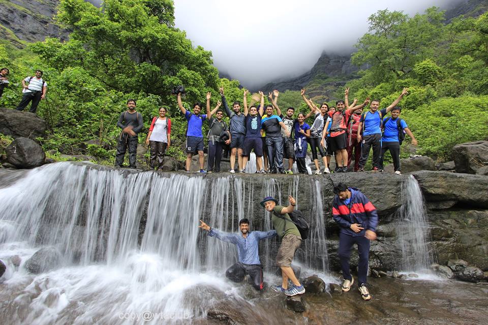
Being a combination of a valley, and a canyon, it is thronged by passionate trekkers, avid walkers and photographers. The whole experience of trekking here is like a dream, where you will feel the wilderness to the core as you walk into the ‘Valley of Shadows’.

Samrad village serves as the base to the trek. At the backdrop from left Alang Madan Kulang and Kalsubai peak

Sandhan valley is located at Samrad village near the Bhandardara region and is surrounded by the Alang, Madan and Kulang mountains.

About the Trek

Normally every trek starts with climbing and then descending. But in the Sandhan valley trek there is no climbing but only descending till the end.The trek can be done by taking 2 routes and has different itineraries.

Trekkers get a view of the valley

The first route covers the entire route and is a 2 day trek, which starts from Samrad village and ends at Dehne village near Asangoan. This is the most preferred route as during the trek you will be able to explore different beautiful spots in the valley and enjoy breathtaking scenieries all around and above all enjoy an overnight camp under the
stars.

Sandhan Valley trek18

The second route cuts short the Sandhan valley trek and takes you back to Kasara ending the trek in a day. This trek is ideal for trekkers who want to experience the trek in a day and would not prefer to camp at night. In this route trekkers will miss out on many spots and beautiful sceneries around the valley. But is ideal for first timers

Trekking at Sandhan Valley

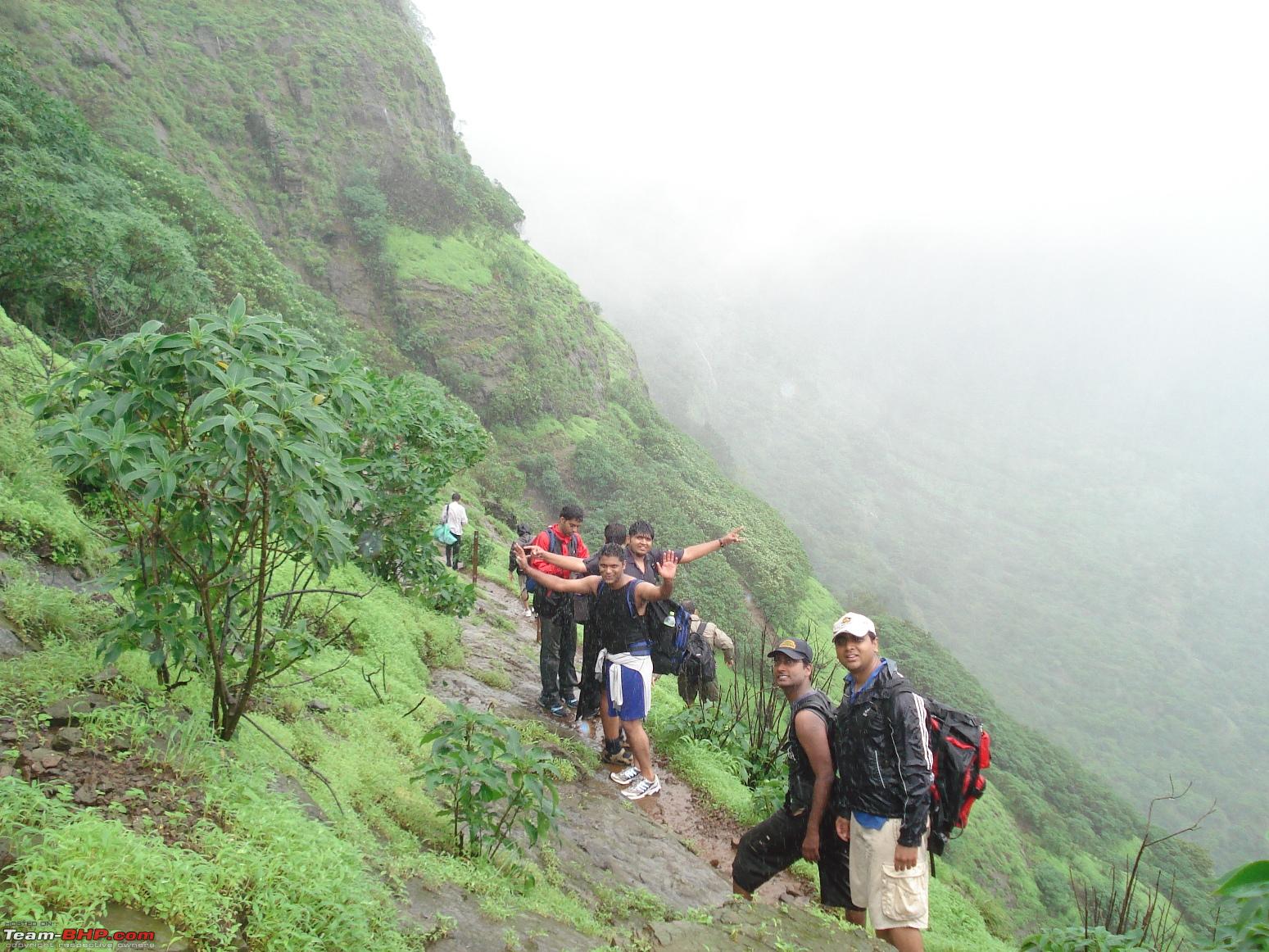
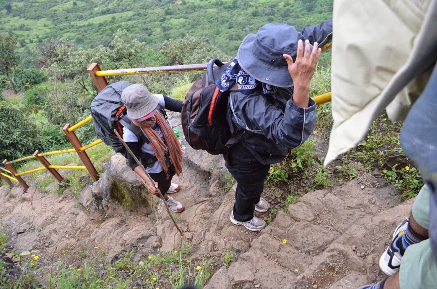
On reaching Samrad valley, it is absolutely essential to hire a guide from the village. Remember this is not an ordinary trek. A local guide is the only help available in this region, who will provide assistance in rappelling, making arrangements for food, exploring the valley, and bringing you down safely from the valley.

Trekkers walk towards the starting point of the trek from Samrad Village

Without assistance this trek is not safe, as it could be dangerous and risky for most city dwellers. Since the villagers are familiar with this place they make the best guides, so do not hesitate and hire them.

The starting point of the gorge at Sandhan valley

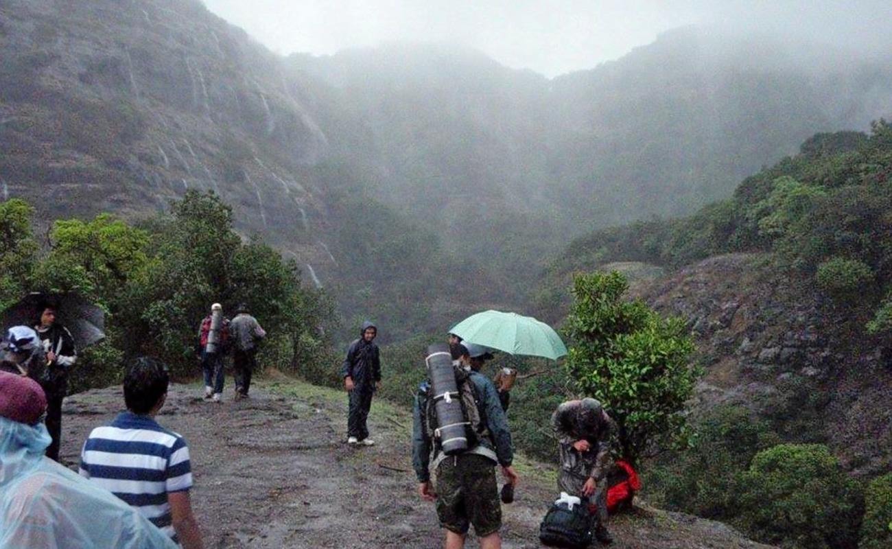
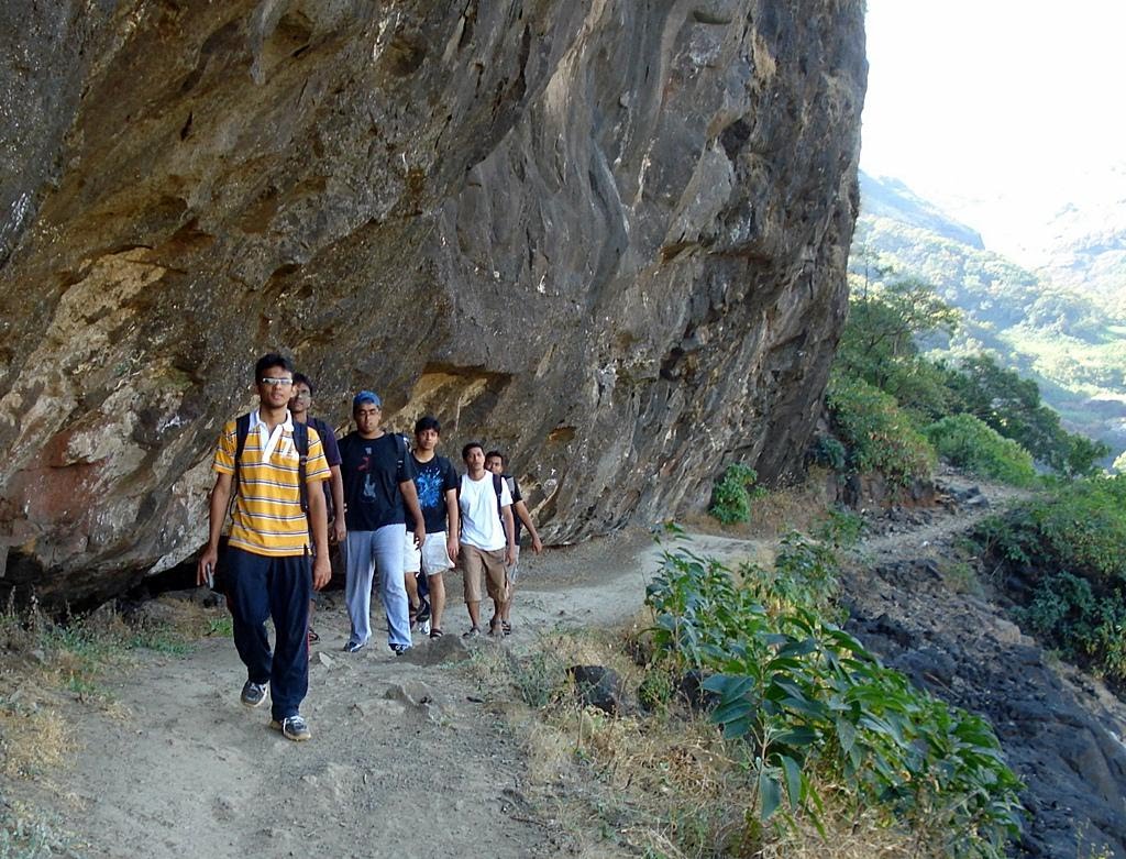
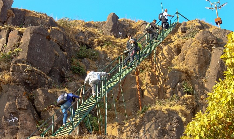
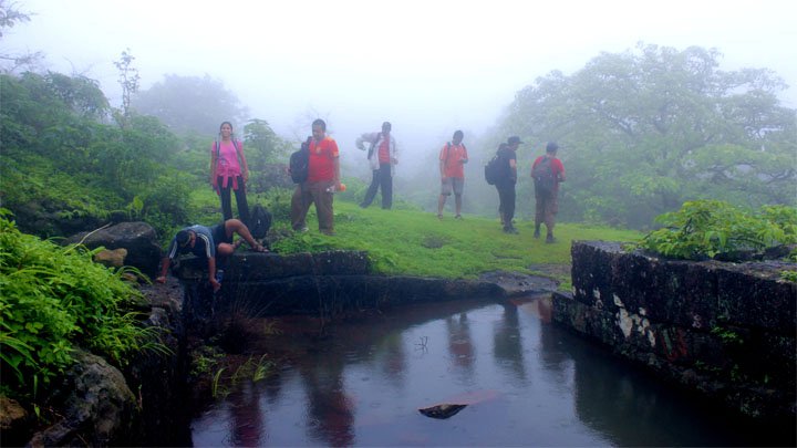
The trek starts from the base village Samrad. Initially the trek is easy as one has to walk on plain ground. After a 10 minute walk trekkers will reach the entrance of the valley. The actual trek starts from here and stretches for 2 km and passes through a deep narrow rock floored ravine which is surrounded by 2 high walls of mountain ranges.

IMG_6335

At certain places the width between the 2 walls is less than 3 feet and even sun rays are unable to reach hence this place is also called as the valley of the shadows. This passage is accessible throughout the year except in monsoons.

1010175_576166759150549_6140017018875458956_n

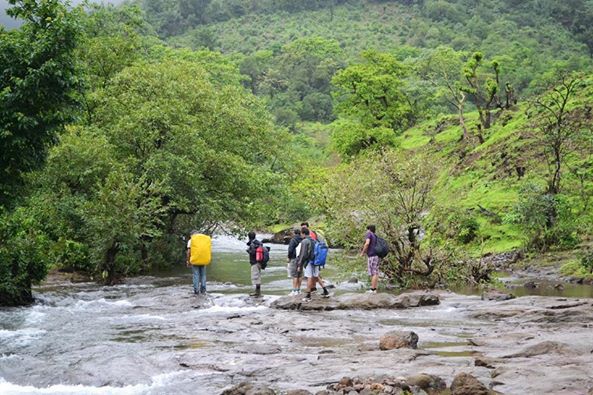
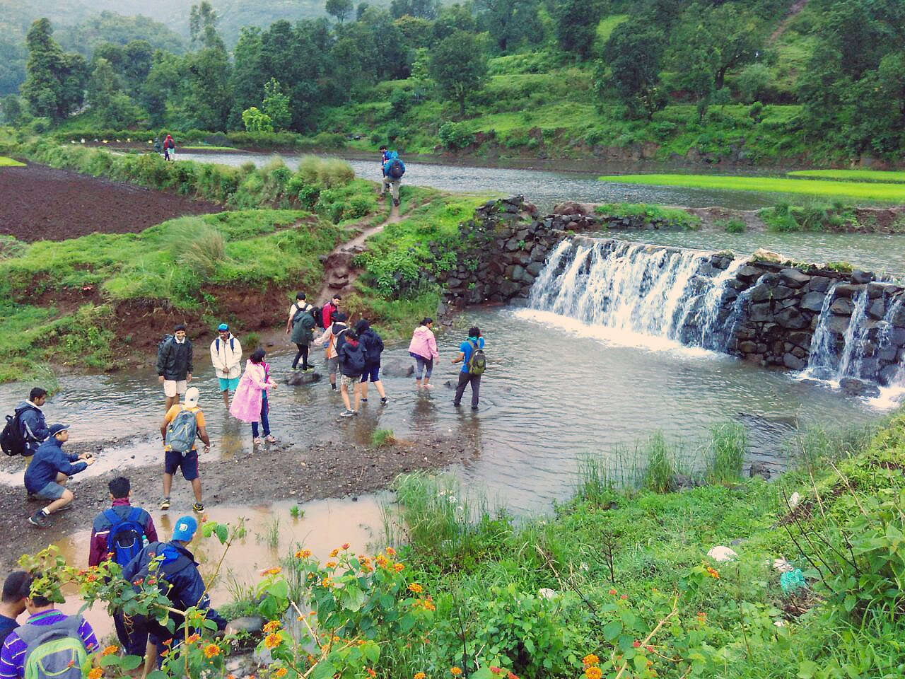
From here on to the end of the gorge, trekkers will have to cross 2 – 3 water pools. The water levels in these pools changes according to seasons. During winters the level is up to waist height and in summers it is up to knee height.

Sandhan Valley trek13

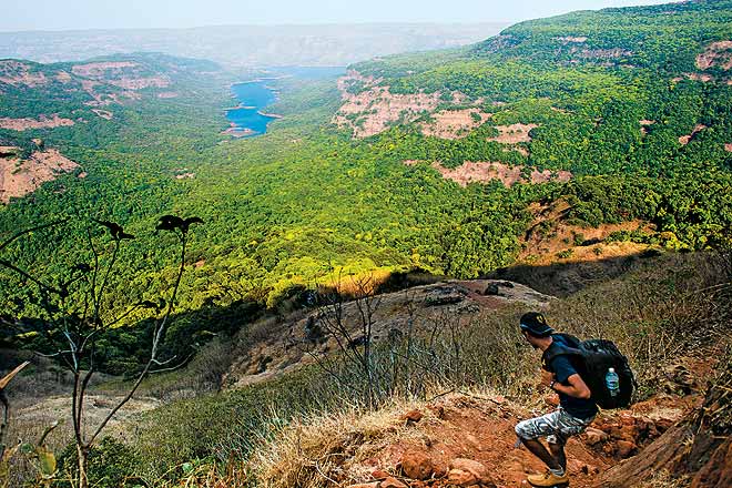
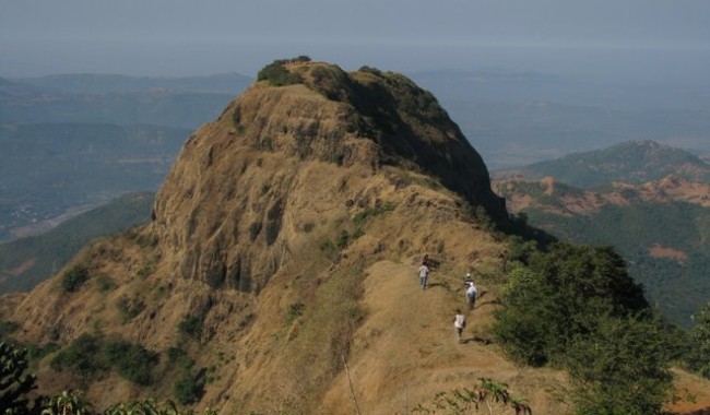
At the end of the gorge trekkers will get magnificent views of the high cliffs and deep valley. At this point trekkers generally take a lunch break and after that begin with the rappelling activity and descend further.

Sandhan Valley trek12

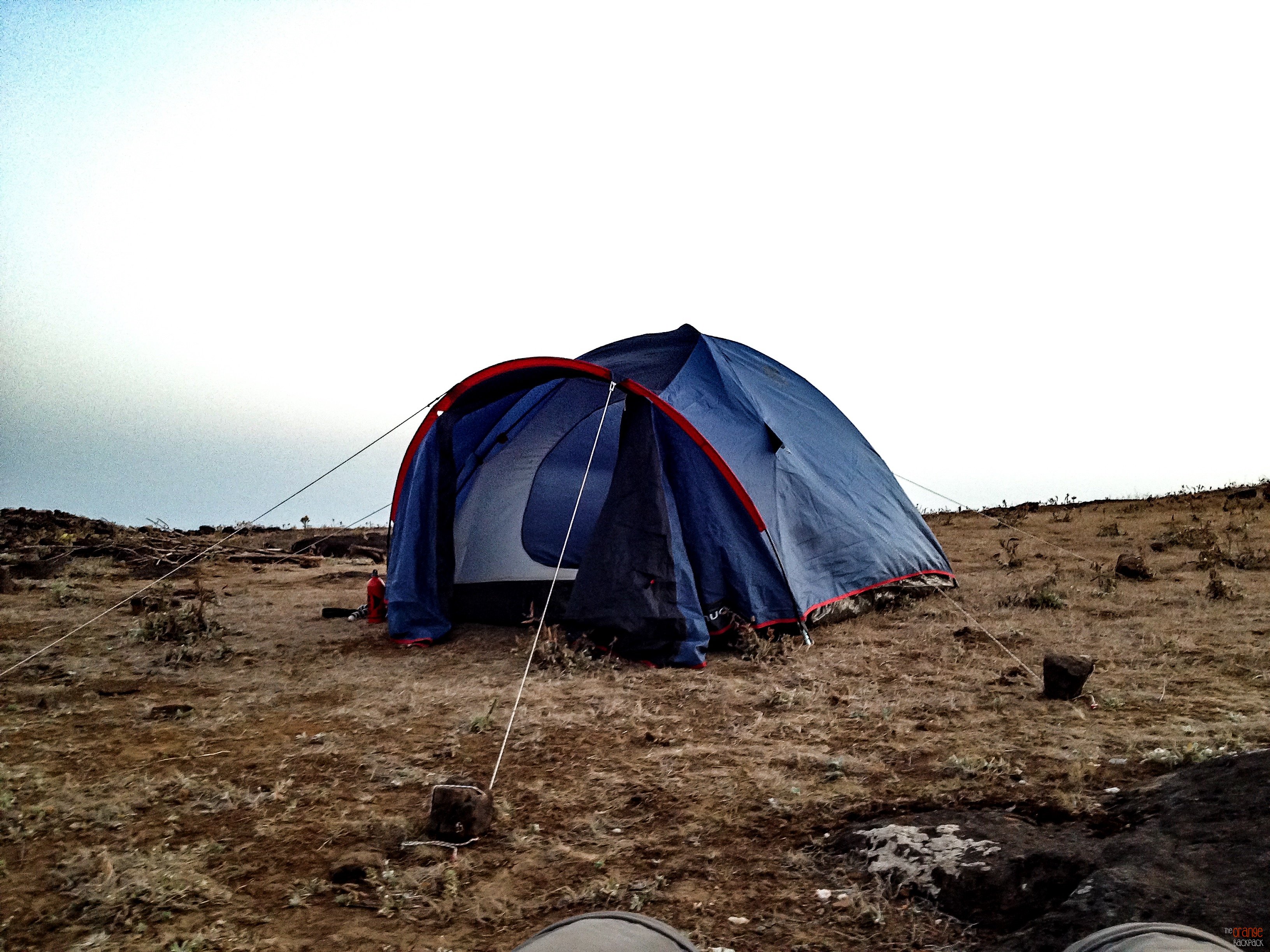
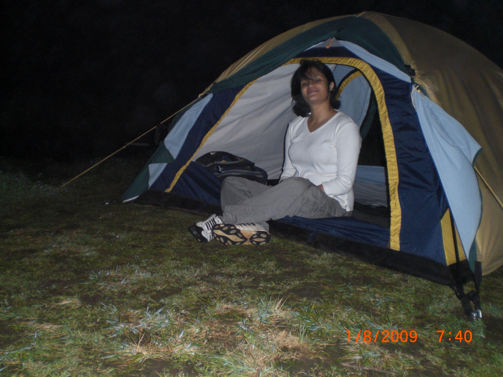
Here trekkers will experience 2 small rappelling patches of varied length the first being 12 feet and the other 25 feet. After climbing down the second rocky patch trekkers will reach a flat plain (Karli ghat) where trekkers can camp for the night.

Sandhan Valley trek 9

Near the campsite (Karli ghat) there is a small stream of fresh water which flows into a huge pond.

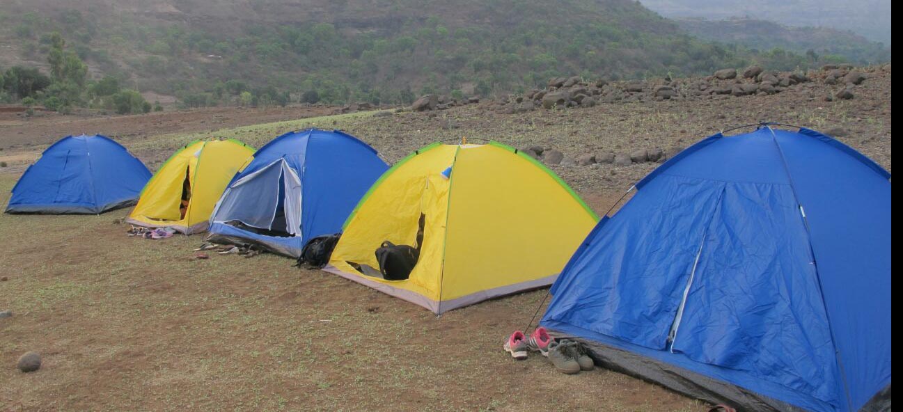
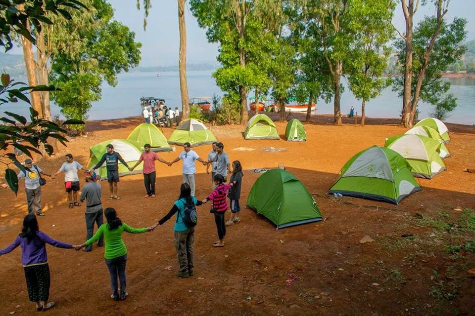
Camping at the Sandhan Valley

After a long day of trekking, trekkers can now camp at the campsite (Karli ghat).These campsites have basic amenities such as tents which houses 3 people along with carry mats and a tent light.

Naneghat Camping & Star Gazing with Trek Mates India

Trekkers can spend the evenings around the warmth of the campsite cooking their meals and enjoy deep conversations followed by dance and music making it a  memorable night.

Trekkers cook food at the campsite

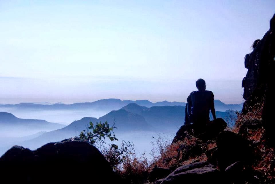
Furthermore, trekkers can enjoy star gazing activity as the skies above the Sandhan valley are darkest in Maharashtra and offers imposing view of the heavens above thus making it an ideal place for photography and astronomy.

Trekkers enjoy star gazing at night.

Later in the morning, trekkers can freshen up, have breakfast and proceed towards Dehne village, Asangoan. After reaching Dehne village, trekkers can have lunch and then proceed to Asangaon station by public transport. From Asangoan station trekkers can board a train towards Mumbai or Pune(via Kalyan).

Camping at Samrad village

Alternate camping : As an alternative it is possible to return back to Samrad village from the campsite (Karli ghat), which will take 3 hours again to reach Samrad and camp at the village. But make sure arrangements for the stay have been made at the village in advance.

Total trek time: 5 – 6 hours.

Best time to visit: Sandgan valley is accessible from November to May. Not recommended during monsoon.

Duration: 1 day/ 2 day.

Grade & Difficulty: Medium (Not advisable for First Time Trekkers).

Bookings for Sandhan Valley Trek PLEASE CLICK HERE

How to reach

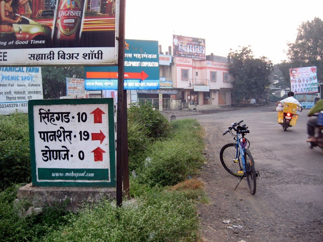
Trekkers generally take an overnight journey from Mumbai towards Samrad village by boarding a Kasara local starting from CST (Chhatrapati Shivaji Terminus Railway Station).

A jeep ride to Samrad village.

They reach Kasara Station by 03:00 am and proceed to Samrad village by a private jeep. After a 3 hour drive, trekkers reach Samrad village early in the morning, they freshen up and have their breakfast by 07:00 am and then start exploring the Sandhan Valley.

Detailed Information

The best way to reach Sandhan Valley from Mumbai is to take a Central Railway train bound for Kasara. The train journey will take around about 2 hours and 40 minutes.

Kasara Railway Station

But it is advisable to check the railway time-table in advance about trains going to Kasara.

Another way would be to take a train to Igatpuri; however Kasara would be a preferable option as there are plenty of local trains to choose from as compared to Igatpuri where only out-bound train are available.

Igatpuri Railway Station

Furthermore, it is more convenient to take a jeep from Kasara to Samrad village which is at a distance of 80 kms and would take about 2.5 to 3 hours to reach the base village. Since the train reaches early morning arrangements for a private vehicle should be made before hand to reach Samrad village.

State Transport bus towards Samrad village

There is also an option to take an ST bus from Kasara or Igatpuri station but one should be fully aware about the ST bus timings as it is very important to reach the village early in the morning to start the trek to Sandhan Valley.

by car

Hiring a private vehicle would be the most suitable and suggested way of getting to Sandhan Valley as this place is not well connected and a bit secluded hence getting public transport is difficult.

By Road

From Mumbai

via Igatpuri & Bhavali -> (Total Distance – 181 km)

Kalyan -> Shahapur -> Kasara -> Igatpuri -> Bhavali -> Ambewadi -> Vasali Phata ->Varaghushi Phata -> Shendi Bhandardara -> Panzare -> Udhawne -> Ghatghar Dam -> Samrad village.

via Ghoti (Ghoti- Bhandardara Road) -> (Total Distance – 199 km)

Kalyan -> Shahapur -> Kasara -> Igatpuri -> Ghoti (Ghoti- Bhandardara Road) ->Vasali Phata -> Varaghushi Phata -> Shendi Bhandardara -> Panzare -> Udhawne ->Ghatghar .Dam -> Samrad village.

From Pune  

via Sangamner -> (Total Distance – 248 km)

Pune -> Narayangaon -> Alephata -> Sangamner -> Akole -> Rajur -> Randha falls -> Ratanwadi phata -> Shendi Bhandardara -> Panzare -> Udhawne -> Ghatghar Dam -> Samrad village.

via Bota – > (Total Distance – 200 km) Recommended Route

Pune -> Narayangaon -> Alephata -> Bota -> Bramhanwada – >Kotul – >Kotul Phata -> Rajur -> Randha falls -> Ratanwadi phata -> Shendi Bhandardara -> Panzare -> Udhawne -> Ghatghar Dam – > Samrad village.

via Otur -> (Total Distance – 200 km)

Pune -> Narayangaon -> Alephata -> Otur -> Bramhanwada -> Kotul -> Kotul Phata -> Rajur -> Randha falls -> Ratanwadi phata -> Shendi Bhandardara -> Panzare -> Udhawne -> Ghatghar Dam -> Samrad village ………The Otur route is single lane route but a scenic pass.

Where to stay

Samrad is a remote village; hence there are no hotels, or lodges here. But the locals at Samrad can help in making arrangements for a home stay.

Trekkers can enjoy a home stay at Samrad village

Most trekkers opt to stay in their own camping tent which is a thrilling experience and undoubtedly the best stay option.

Tented stay in Sandhan Valley

If you have booked your trip with a trek organizer, then they will take care your stay, which will be at a campsite along with other facilities. Furthermore, there are no shops in Samrad, hence it is recommended to carry snacks, packaged drinking water and medicines.

Bookings for Sandhan Valley Trek PLEASE CLICK HERE

Where to eat

The villagers of Samrad are friendly, hospitable and helpful people, alongside farming they earn a livelihood by making food and stay arrangements for trekkers and picnickers at a very nominal cost.

Sandhan Lunch time

There is home cooked, local Maharashtrian fare is available consisting of Bhakri, Bhaji, Dal, Usal, Rice, Thecha and pickle.The breakfast menu could be Poha, Upma or Maggi with piping hot tea all cooked on a clay oven.

food at sandhan valley

There are no shops or eateries at Samrad village. Trekkers are advised to make their own arrangements with the villagers before starting for the trek.

Places of Interest near Sandhan Valley


Amruteshwar Temple
Amruteshwar Temple
  • Randha Waterfalls
  • Bhandardara Dam
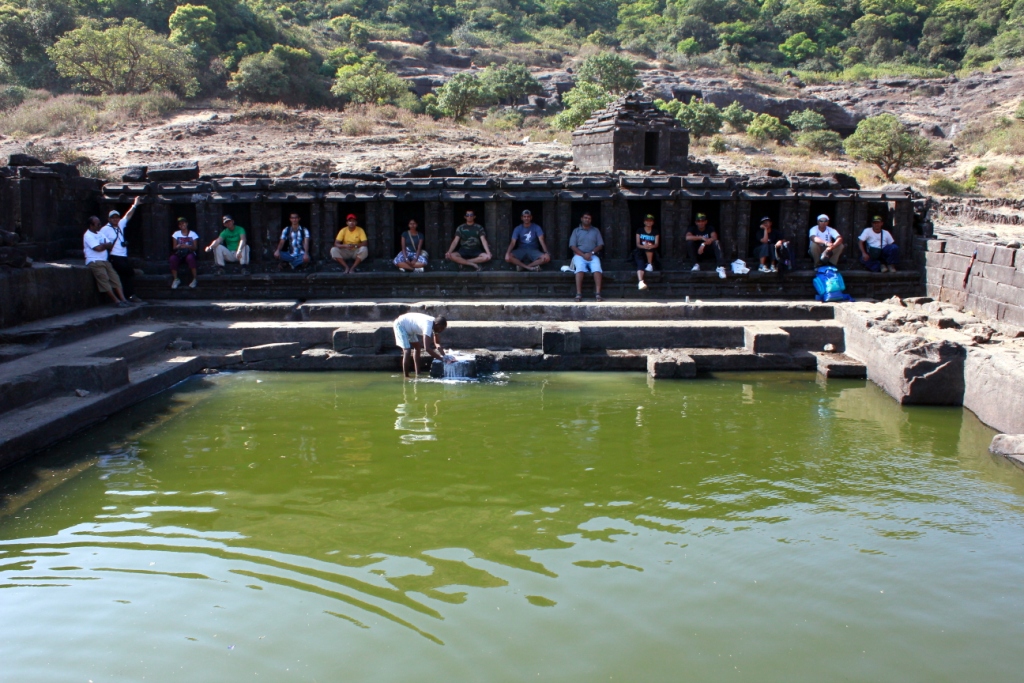
  • Amruteshwar Temple at Ratanwadi temple
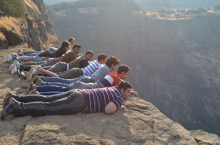
  • Kokan Kada (A view point to enjoy the beauty of the Sahyadri’s)
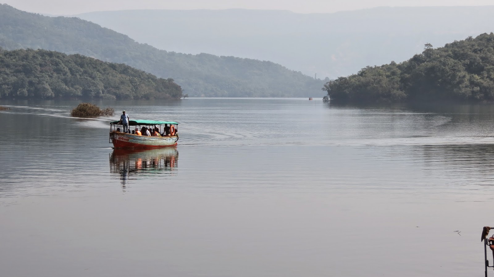
  • Bhandardara backwater near Samrad village
  • Ghatghar Dam
  • Ghatnadevi temple

Giant Swing at the Valley

The Giant Swing is an activity conducted by a trekking group in the valley. It is one of India’s first natural giant swing set-up wherein a participant swings from a height of 500 feet. This is an extreme adventure sport activity and is done under professional guidance and assistance.

Gaint swing at Sandhan Valley

Note: Please check the credentials of the organizers before you indulge in this extreme sport activity.

Things to carry for Sandhan Valley Trek

  • Camping tents
  • Toilet tents
  • Sleeping bags
  • Mats
  • Rappelling gear
  • Basic food items
  • Utensils for cooking
  • Safety Equipment’s
  • First-aid Kit
  • Rope Harness
  • Helmets.

Important things to know

  • Sandhan Valley FULL DESCEND TREK is not advisable for first timers or unfit participants.
  • Hire a guide and technical support for rappelling activity.
  • Manage your time well as descending is time consuming here.
  • Carry ample water as there is no portable water source during the trek, besides a stream of water near the camping site at Karoli ghat.
  • Do not attempt this trek in monsoon as the valley and the gorge is flooded with water.
  • Wear good quality trekking shoes.
  • Trek here in a large group this ensures safety in case of extreme situation.

Bookings for Sandhan Valley Trek PLEASE CLICK HERE

Rajgad Fort Trek

Rajgad Fort during monsoon

Location: Near Karjat
Distance from Mumbai: 204 km
Distance from Pune: 60 km
Trekking Duration: 1 day / 2 day / 3 day
Trekking Length: Via Pali: 2.5 hours and Via Gunjawane: 3.5 hours
Starting point: Gunjawane / Bhor / Pali. (3 base villages)
Best season: Monsoon / winter
Difficulty: Moderate / Medium
Height: 1295 mt (4250 feet) above sea level

The Maha Darwaza en route Balekilla

What to see at the fort:

  • Sanjeevani Machee
  • Padmavatee Machee
  • Padmavati temple
  • Rameshwaram temple
  • Alu Darwaza
  • Pali Darwaza
  • Suvela Machee
  • Balekilla      (The highest point on the fort)
  • View of Torna and Sinhagad forts
  • Chor Darwaza
  • Gunjavane Darwaza
  • Ardhchandra Lake

A brief history

Rajgad means ‘The King of Forts’ and is considered as one of the most important forts in Maharashtra as far as the cultural heritage of the state is concerned. The Rajgad fort as an interesting history and was home to Shivaji for over 25 years till he became the Chhatrapati. Post coronation he shifted his capital to Raigad. But the fort has witnessed lots of historic events, including the birth of Shivaji’s son Rajaram, the death of Shivaji’s Queen Saibai, the return of Shivaji from Agra, the burial of Afzal Khan’s head in the Maha darwaja walls of Balekilla and many more historic wars and events.

Trekkers make their way up to the fort

Description

Rajgad is amongst the most popular trekking destinations near Pune. A majestic fort of Rajgad, offers a panoramic view of the surroundings and the best time to visit the Rajgad fort is just after monsoons, however one would find trekkers at Rajgad fort on weekends all throughout the year.

The Rajgad Fort Trek 2

There are 3 ways to reach the top of the fort

Via Pali Route:

This trek starts from Pali village and this route takes one through the Maha – Darwaza. This route is easy to trek on and ideal for first timers.

Via Gunjawane Route:

This trek starts from Gunjawane village and this route takes one through the Chor – Darwaza. This route is slightly difficult as compared to Pali route.

Via Bhor Route:

After reaching Bhor, trekkers should move towards Bhutonde village and start their trek. This route is shorter than the other routes (Pali & Gunjawane) mentioned, but is not very popular with trekkers as it is very slippery during monsoon season. But during winters trekkers can try this route as it offers a different experience.

The Rajgad Fort Trek 3

Once at the top of the fort, the beauty of the fort and the surroundings is mesmerizing. The sunrise from Balekilla is a must watch. The fort offers magnificent views of the lush green Sahyadri range. During the month of October the entire area is covered with colorful wild flowers combined with clear blue sky and the splendor of the fort is captivating.

Camping Info

Camping here is ideal during winter and it is always advisable to carry your own camping gear or hire one. Trekkers can also take shelter at the Padmavati temple with can accommodate at least 30 people at night and there is water available at the top of the fort all round the year. But do carry sufficient food in case you are camping overnight.

A Shiv Temple at Padmavati machi where campers can take shelter

Recently the local authorities have set up guest rooms on the top of the fort but kindly enquire about their availability incase you plan to stay overnight at the fort.

Furthermore, unlike other forts you do not need to carry or search for fire wood as the local villagers sell fire food at cheap rates and are sufficient for the night.

How to reach

Rajgad-Fort-2

From Pune – >

Rajgad fort is 60 km from Pune city.
There are several S.T (State Transport) buses are available from Swargate to village Gunjawane. Trekkers can also board buses for Velha and get down at Gunjawane Phata, from here they can take share rickshaws or other local transport to the base village.

If you travelling by private vehicle then take the Pune – Satara road route and reach Nasrapur Phata from there a road leads you to Gunjawane village.

From Mumbai – >

Trekkers can reach Pune and then follow the above mentioned route to reach Rajgad Fort.

For bookings for a Monsoon Trek to Rajgad Fort  PLEASE CLICK  HERE

Caution: The roads and trails leading to the fort are quite slippery during Monsoon so be careful while venturing on a trek.For more information read: Precautions to be taken during Monsoon trekking.

Shivneri Fort Trek

A view of  Shivneri Fort from Jun

Location: Near Junnar
Distance from Pune: 125 km
Distance from Mumbai: 160 km
Trekking Duration: 1 day
Trekking Length: 2 hours
Starting point: Junnar
Best season: Monsoon / winter
Difficulty: Medium
Height: 1066 (mt) / 3500 (feet) above sea level

What to see at the fort

  • Temple of goddess Shivai after whom Shivaji Maharaj was named
  • Kadelkot Point ( execution point from where criminals were thrown)
  • Ambarkhana (Food storage place used in olden days to store rations)
  • Water Springs on the fort(Ganga & Jamuna)
  • Statue of Shivaji Maharaj and Jijabai
  • Badami Talab( A water reservoir)
  • 7 gateways of the fort
  • Kamani Masjid
  • Panoramic views of Junnar from the top

Entry is free to the fort and the timings are: 6:00 a.m. to 5:00 p.m.

The birth place of Shivaji Maharaj

A brief history

The fort of Shivneri is one of the historically important forts of Maharashtra as it was the birth place of Shivaji Maharaj who spent the major part of his childhood here. There is a temple of goddess Shivai in the close vicinity of the fort and Shivaji was named after the goddess. Shivaji left the fort in the year1632 and it was soon taken over by the Mughals in 1637.For regional dominance the fort was witness to many tussles between the Mughals and the Marathas only to fall later in the hand of the Peshwas.

Shivneri Fort 1

Trekking Shivneri fort is fairly easy, and there are 2 options for trekkers, one is to trek all the way to the top from the base village, and second take the motor able road half way to the top and start the trek from there. After that there is a series of stairs (400 steps) that lead to the top.

One of the grand gateways of the fort

The ascending paths will take trekkers to a series of 7 gateways Maha Darwaja, Ganesh Darwaja, Pir Darwaja, Hatti Darwaja, Shivai Darwaja, Mena Darwaja and Kulup Darwaja that once safeguarded the fort. On the way trekkers will notice a lot of restoration work on the fort in progress, there are informative signs for trekkers and beautification is in full swing to bring it back to its past glory.

Trekkers at Shinaeri Fort

During monsoons the Gulmohar trees here are in full bloom and while trekking one will get breathtaking views as they ascend the fort. Once at the top, trekkers will be rewarded with picturesque views of the surrounding valleys and can explore the historic attractions within the fort.

Trekkers can also explore nearby attractions like the Lenyadri Buddhist caves,  Girijatmaj Ashtavinayak Ganesh Mandir, which is about 8 km away. Malshej Ghat is well known for its monsoon scenery is also close by and trekkers can club this spot during their visit to the Shivneri fort.

Camping info

Depending on the local authorities and season, camping may or may not be allowed at the Shivneri fort. But there are plenty of caves where trekkers can take shelter at night, but it is always advisable to take your own or hire camping equipment.

Trekkers enjoy camping at the nearby Malshej ghat

Trekkers must carry sufficient food and water as there are no proper facilities at the fort or in the nearby areas.Trekkers can also opt for overnight camping at the Malshej Ghat which is a few km away from Shivneri Fort.

How to reach

From Mumbai – >

The sleepy town of Junnar is at a distance of 2 km from the Shivneri Fort. Trekkers can reach Junnar from Mumbai or Kalyan via Malshej Ghat or Khandala Ghat.Though the route through Malshej Ghat is preferred as it takes lesser time.

Trekkers using public transport can board S.T buses from Kalyan as there are several buses plying between Kalyan and Junnar.While private vehicles can reach Junnar via Malshej Ghat.

From Pune – >

From Pune or Shivaji Nagar one can take S.T buses for Junnar. Buses ply on an hourly for Junnar from these bus stands.Distance between Junnar Bus stand and Shivneri base village is 2 km by road.

For bookings for a Monsoon Trek to Shivneri Fort  PLEASE CLICK  HERE

Caution: The roads and trails leading to the fort are quite slippery during Monsoon so be careful while venturing on a trek.For more information read: Precautions to be taken during Monsoon trekking.

Pratapgad Fort Trek

A view of the Pratapgad Fort during Monsoon

Location: Near Mahableshwar / Satara district
Distance from Mumbai: 220 km
Distance from Pune: 140 km
Distance from Mahableshwar : 20 km
Trekking Duration: 1 day / 2 day
Trekking Length: 2 hours
Starting point: Pratapgad fort parking
Best season: All round the year. Monsoon is the ideal time
Difficulty: Easy
Height: 1080 (mt) / 3545 (feet) above sea level

What to see at the fort

  • Entrance of Bale – Killa
  • Watch towers on the fort
  • Statue of Shivaji Maharaj
  • Bastions on the fort
  • Beautiful Sahyadri mountains surrounding the fort
  • Afzal Khan’s dargah
  • Bhavani Temple
  • Afzal Tower
  • Rahat Lake – Biggest lake on the fort
  • Heavy Canons at the top

Timing: 08:00 a.m. to 05:00 p.m. (Plan your visit well ahead of closing time).

Trekkers interested in history of the fort must keep at least 2 hours aside for exploring the fort.

A Statue of Shivaji Maharaj at Pratapgad Fort

A brief history

Pratapgad fort was built by Shivaji Maharaj during mid 16th century in order to defend the banks of Nira and Koyna River as they were major trade route during that time. But the real reason for the forts popularity was for its famous tussle between Afzal Khan and Shivaji Maharaj, in which Afzal Khan lost his life. During the 18th century it was in control of the British Empire and continued to be the center of regional politics. In present times it remains the only fort of Maharashtra which is privately owned by someone (Uday Raje Bhosale), the heir of the princely state of Satara.

Trekkers make their way to the top at Pratapgad Fort

Description

Pratapgad fort is not very popular with experienced trekkers but is ideal for first time trekkers who want to get used to trekking forts. There is no specific trekking trail between the woods instead there is a series of 450 plus steps from the base of the fort to the top. Trekking here during the monsoon is ideal as one will get a glimpse of several waterfalls on the way and adds to the beauty of the place. Once trekkers reach the top they fill find well preserved fortifications, historic monuments and 360 degree panoramic views of the valley.

Camping Info

There is plenty of space for camping at the top of the fort, but it is advisable to carry your own camping equipments including tents.

Camping at Pratapgad Fort

Though there is a temple at the top of the fort, where trekkers can spend the night camping, but during weekends it gets crowded, and there is not much space for sleeping within the temple premises.

How to reach

Trekkers can club their visit to Pratapgad Fort with a trip to Mahableshwar.

By Road: Mahabaleshwar can be easily reached from both Mumbai and Pune as there are regular buses and cabs to Mahabaleshwar throughout the day.

After reaching Mahableshwar trekkers can board an S.T. bus or hire a private cab to reach Pratapgad fort which is 20 km away.

For bookings for a Monsoon Trek to Pratapgad Fort  PLEASE CLICK  HERE

Caution: The roads and trails leading to the fort are quite slippery during Monsoon so be careful while venturing on a trek.For more information read: Precautions to be taken during Monsoon trekking.

Ratangad Fort Trek

A view of the Ratangad Fort from the base village

Location:  Ratanwadi / Akole Taluka / Ahmednagar
Distance from Pune: 215 km
Distance from Mumbai: 180 km
Trekking Duration: 1 day
Trekking Length: 3 hours to the summit
Starting point: Ratanwadi is the base village
Best season: Monsoon and winter
Difficulty: Easy / Medium
Height: 1142 mt (4250 feet) above sea level

What to see at the fort

  • A small Ganesh temple within a cave.
  • Big and small caves scattered around the fort
  • Ruins of Rani Mahal
  • Pravara river originates in Ratangad
  • The Amruteshwar Temple at Ratanwadi(base village)
  • View of the scenic beauty surrounding the fort from the top
The ancient Amruteshwar temple at the base village Ratanwadi

A brief history

The Ratangad fort is believed to be about 2000 years old. It was initially having a number of naturally formed caves, but gradually over the centuries, its inhabitants built the fort around the natural rock structures. The fort has a rock peak, with a cavity in it at the top, which is called ‘Nedhe’ or ‘Eye of the Needle’.

Ratangad Fort trek 2

In recent history the fort was captured by Shivaji Maharaj and it is believed that it was one of his favorite forts because of the natural scenic beauty surrounding the fort. The base village Ratanwadi also has historic importance as it is home to the Amruteshwar temple whose origins can be traced back to Hemandpant era of the 8th century. The fort is also said to be the origin of the Pravara River and the Bhandardara dam has been built on this river.

Ratangad Fort trek 1

The Ratangad fort trek is a fairly simple trek, which passes through small fields and thick forests by the Pravara River. The trek is divided into 3 stages; each stage is separated by small plateaus. Towards the end of the trek there are 2 iron ladders one after another, which takes trekkers to the top of the fort.

Ratangad Fort Trek

For trekkers trekking Ratangad for the first time it is advisable to hire a guide from the base village (Ratanwadi) as during the rainy season the terrain can be confusing and also the actual fort may not be visible due to the presence of dense fog from the base village.

Camping Info

Ratangad is a great location for camping. There are a number of caves at the fort and are spacious, there is a cave at the summit which is big enough to accommodate about 20 people and has an iron grill which can be closed at night for safety atop the fort, although carrying your own tent would always be advisable.

Camping at Ratangad

During weekends the villagers do set up small stalls and serve ‘Pitla Bhakri’ and tea but do not bank on it and carry enough water and food. Trekkers can also opt to camp near Bhandardara Lake or stay there as the place has some good staying options.

How to reach

Route from Mumbai to Ratangad fort

By Private Vehicle (Car/Cab)
Take the following route:
Mumbai – > Thane – > Padgha -> Shahapur -> Khardi -> Kasara -> Igatpuri -> Ghoti -> Bhandardara -> Ratanwadi -> Ratangad fort.

By Public Transport (Bus / Train)

From Mumbai there are ST (State Transport) buses or trains available to Igatpuri, distance between Mumbai to Igatpuri are 121 kilometers, from here there are ST (State Transport) buses and local transport available to Bhandardara or Shendi village, from here on there are local transport available to Ratanwadi village.

From Mumbai there are trains available to Igatpuri, from Mumbai to Igatpuri is around 121 kilometers, and then follow the same route from Igatpuri as mentioned above.

Route from Pune to Ratangad fort

By Private Vehicle (Car/Cab)
Take the following route:
Pune -> Lonikand -> Shikrapur -> Ranjangaon -> Shirur -> Ahmednagar -> Rajuri -> Shendi -> Ratanwadi -> Ratangad fort.

By Public Transport (Bus / Train)
From Pune there are direct ST (State Transport) buses available from Shivajinagar to Rajuri (Ahmednagar), From Rajuri there are local transport are available to reach at Shendi village, from here there are taxi available to reach at Ratanwadi village.

From Pune junction there are trains available to Ahmednagar, from Ahmednagar there are ST (State Transport) buses and local transport available to Rajuri, and then follow the same route from Rajuri mentioned above.

For bookings for a Monsoon Trek to Ratangad Fort  PLEASE CLICK  HERE

Caution: The roads and trails leading to the fort are quite slippery during Monsoon so be careful while venturing on a trek.For more information read: Precautions to be taken during Monsoon trekking.

Harishchandragad Fort Trek

Harishchandragad Fort 1

Location: Malshej Ghat / Ahmednagar
Distance from Mumbai: 210 km
Distance from Pune: 165 km
Trekking Duration: 1 day / 2 day
Trekking Length: 6 hours
Starting point: The fort can be reached by 3 routes via Khireshwar / Belpada / Kothale villages.
Best season: Monsoon and winters
Difficulty: Moderate / Medium
Height: 1435 mt (4710 feet) above sea level

What to see at the fort:

  • Kedareshwar Caves
  • Konkan Kada
  • Taramati peak
  • Views of Naneghat and forts near Murbad
  • Kedareshwar Temple
  • Other Caves
Trekkers relax at the caves of Harishchandragad

A brief history:

The Harihchandragad fort is an ancient fort with its origins dating back to the 6th century. The caves situated at the fort have ancient temples and carvings of deities which suggest that the fort belongs to the medieval period. According to recent history the fort was in control of the Mughal Empire during the 17th century and was later in control of the British Empire.

Trekking at Harishchandragad 1

Harishchandragad is a beautiful hill fort and a popular trekking destination. The trek here is difficult and long and is not recommended for summers. The best season for Harishchandragad trek is just after monsoons and winters. The most popular base for Harishchandragad trek is the Khireshwar village. From Khireshwar Harishchandragad trek is about 9 Km long. The trek route to Harishchandragad is via Junnar Darwaza and Tolar Khind. Enroute the Harishchandragad trek one would cross seven hills each offer magnificent views.

Trekking at Harishchandragad 2

The most fascinating spot in Harishchandragad fort is the Konkan Kada. One can have a breathtaking view of the surrounding region from here. Taramati peak is another spot for panoramic view of the valleys and is the second highest peak in Maharashtra. There are a few ancient caves and temples at Harishchandragad fort. The temple of Harishchandreshwar and Kedareshwar Cave is worth a visit.

Trekking at Harishchandragad 3

Routes:

There are 3 trekking routes to the fort. One via Khireshwar village, via Nalichi Vaat(This is extremely difficult), via Pachnai village(This is the easiest route).

The Khireshwar village route is one of the most preferred routes as it offers scenic views while trekking, but this route is a bit time consuming.

An ancient  temple of Harishchandragad
An ancient temple of Harishchandragad

Camping info:

There are several caves at the fort which can be used for overnight camping and can accommodate a 100 people. Trekkers can also carry their own tents and sleeping bags.

Trekkers making arrangements for am overnight camp at Harishchandragad fort

Carry plenty of water and food as there is no source of portable water or edible food at the fort or base villages. Collect enough fire wood before night fall as the temperature at night is really low at the top and carry enough warm clothing.

2

How to reach:

Mumbai to Khireshwar
Mumbai – > Kalyan – > Via NH 222 – > Malshej Ghat – > Khireshwar – > Harishchandragad fort

Mumbai to Pachnai
Mumbai > Ighatpuri > Ghoti -> Bari – > Rajur -> Pachnai village – > Harishchandragad fort

Pune to Khireshwar
Pune -> (NH 50 Nashik Highway) – > Alephata – > Otur – > Khireshwar – > Harishchandragad fort

Pune to Pachnai
Pune – > Alephata – > Sangamner – > Akole -> Rajur -> Pachnai village – > Harishchandragad fort

For bookings for a Monsoon Trek to Harishchandragad Fort  PLEASE CLICK  HERE

Caution: The roads and trails leading to the fort are quite slippery during Monsoon so be careful while venturing on a trek.For more information read: Precautions to be taken during Monsoon trekking.

Vasota Fort Trek

Vasota Fort
Vasota Fort

Location: Near Satara
Distance from Pune: 250 km
Distance from Mumbai: 280 km
Trekking Duration: 1 day / 2 day
Trekking Length: 3 hours to reach to the summit
Starting point: Bamnoli is the base village
Best season: All round the year
Difficulty: Difficult (Ideal only for regular trekkers)
Height: 1171 mt (3842 feet) above sea level

What to see at the fort

  • Nageshwar cave with a Mahadev temple inside
  • Views of Babu Kada
  • Spectacular views of Koyna backwaters and of the Wild Life Sanctuary
  • Trek through the  jungle(wild life reserve)
  • Enjoy a boat ride through the Koyna backwaters
  • Ideal location for wild life photography
The view from Vasota Fort

A brief history:

According to historians the Vasota fort was under the Maratha rule during the 16th century. It was named Vyaghragad(meaning tiger) by Shivaji Maharaj because of its defensive capability. Later it was in control of the Peshwas (Bajirao Peshwe) only to fall in the hands of the British empire during the 18th century who bombarded the fort and destroyed many structures within the fort.

Trekkers take a  boat ride to the base of the Vasota Fort
Trekkers take a boat ride to the base of the Vasota Fort

There are 2 forts i.e. old and new, the old Vasota is inaccessible and trekking is carried out only at the new Vasota fort. This is a dream trek for every trekker as it offers a thrilling experience of walking through a dense forest full of wild animals and an opportunity to get close to nature. On the way up trekkers will Get a glimpse of a Hanuman temple, water reservoirs, old dilapidated structures and the Nageshwar cave which is home to the Mahadev temple.

Trekkers on reaching the base of the Vasota fort after a boat ride

On reaching the half way trekkers will be rewarded with spectacular views of the Shivsagar Lake and the surrounding beauty of the jungle. Trekkers must ensure that they trek in a group and at no point of time should anyone stray away as the jungle is home to a number of wild animals like wild dogs, sloth bears, leopards and even tigers. Trekkers are advised to carry plenty of water and food as the trek to the summit takes about 3 hours and can be tiring.

Trekking through the dense jungles of Vasota fort

Please note:

  • Since the fort is in the middle of a dense jungle trekkers must take proper precautions during monsoon as the area is full of leeches.
  • Fort Vasota comes under Project Tiger hence prior permission has to be taken from the forest department. Trekking clubs and groups generally take care of these permits in case you not associated with any club or group then make arrangements for the permits.
  • Reach Bamnoli village by 8:00 a.m. as you will then get enough time to trek and explore the fort and jungle. Leave the fort latest by 03:30 p.m. as it is not safe to descend late at dark.

Camping Info:

Camping at the fort or in its surrounding areas is not permitted by the forest department as it lies under a wild life sanctuary and attracts wild animals at night.

Camping by the Lake
Camping by the Lake

Trekkers can enjoy camping at the Bamnoli (base village) and set up a campsite along the beautiful Shivsagar Lake and enjoy its beauty.

How to reach:

From: Mumbai - > Pune – > Satara -> Bamnoli village

From: Pune – > Satara -> Bamnoli village

Once at Bamnoli trekkers have to take a boat ride on the Shivsagar Lake for about one and a half hour which will take them to the base of the fort. This is where the actual trek begins.

The boat ride offers breathtaking views of the mountains and sceneries surrounding the lake. Traveling in a large group makes the boat ride cost effective.

For bookings for a Monsoon Trek to Vasota Fort  PLEASE CLICK  HERE

Caution: The roads and trails leading to the fort are quite slippery during Monsoon so be careful while venturing on a trek.For more information read: Precautions to be taken during Monsoon trekking.

Kalsubai Peak Trek

Kalsubai Trek
Kalsubai Trek

Location: Akole Taluka / Igatpuri / Ahmednagar
Distance from Pune: 175 km
Distance from Mumbai: 160 km
Trekking Duration: 1 day
Trekking Length: 3 hours to the summit
Starting point: Bari Goan is the base village
Best season: Monsoon / Winter
Difficulty: Moderate / Medium (not for first time trekkers as the way up takes about 3 hrs).
Height: 1646 mt (5400 feet) above sea level.

What to see at the fort:

  • Kalsubai temple at the summit
  • Highest peak in Maharashtra
  • View of nearby forts
  • Being the highest peak it commands beautiful views of surrounding
  • Get a feel of the clouds touching the mountains

Kalsubai Trekking 1

A brief history:

Kalsubai, according to local legend, was the name of a tormented daughter-in-law who ran away to the top of a hill to escape harassment from her in-laws. She is believed to have disappeared here and the locals built a temple in her memory on the peak’s summit. The hill is named Kalsubai after her.

Kalsubai Trekking 2

Kalsubai is the highest peak in Maharashtra and is one of the most enjoyable treks. The route to the top is well marked and many trekkers and pilgrims visit to reach the peak which has a small temple of Kalsubai. During monsoon the peak is like being in heaven and is covered with fog and has strong winds blowing. But the best time to visit is during September just after monsoon when there are thousands of wild flowers blooming everywhere and the climate is just perfect for a trek.

Kalsubai Trekking 3

Kalsubai trek has three ladders which have been installed by locals to make the trekking route till Mount Kalsubai easy. When trekkers reach the carved steps and later ladder from Bari Village you would have covered 1/3rd of the trek. After all the ladders are over 2/3rd of the trek is over.  After a decent walk on plateau you will reach the final ladder till Kalsubai summit. Trekking Kalsubai peak takes about 3 hours and can be very tiring hence carry enough food and water. Trekkers can also take a night trek in winter and enjoy the sunrise at Kalsubai.

Kalsubai Trekking 4

Camping info:

Camping in and around Kalsubai is possible and campers can bring in their own tents and rations for the night. However the best option for camping would be by the Arthur Lake near Bhandardara. Bari the base village is less than half an hour from Bhandardara with the rugged Sahyadri hills providing the perfect backdrop for the tranquil lake.

Camping in Kalsubai

How to reach:

From Mumbai ->

It takes about 3 hours to reach Kalsubai from Mumbai by road. Hence it is advisable to take the road route rather than the train from convenience point of view.

If you’re planning to make an overnight journey then plan your stay at Bhandardara which is about 20 km from the base village of Bari. Nature enthusiasts can also camp at the banks of Bhandardara Lake.

Best route from Mumbai to Kalsubai: Mumbai –> Kalyan –> Asangao –> Sakurli –> Ghatgar –> Bhandardara –> Bari –> Kalsubai.

Alternate route: Mumbai –> Kalyan –> Asangaon –> Khardi –> Igatpuri –> Ghoti –> Bari –> Kalsubai.

From Pune – >

Pune -> Nasik Phata -> Narayangao -> Otur -> Bhramanwada -> Kotul -> Rajur -> Bhandardara – >Bari -> Kalsubai

There are several S.T(State Transport) buses plying between Pune and Bhandardara. From Bhandardara trekkers can hire local transport and reach Bari the base village for the Kalsubai trek.

For bookings for a Monsoon Trek to Kalsubai Peak  PLEASE CLICK  HERE

Caution: The roads and trails leading to the fort are quite slippery during Monsoon so be careful while venturing on a trek.For more information read: Precautions to be taken during Monsoon trekking.

Jungli Jaigad Trek

Jungli Jaigad Fort
Jungli Jaigad Fort

Location: Near Koyna Lake / Koyna Nagar
Distance from Mumbai: 250 km
Distance from Pune: 210 km
Trekking Duration: 1 day
Trekking Length: 2 hours
Starting point: Navja is the base village
Best season: Winter and Monsoon (Early monsoon is the best time)
Difficulty: Moderate / Medium
Height: 902 mt (2957 feet) above sea level

What to see at the fort:

  • Natural beauty surrounding the fort (Koyna Wildlife Sanctuary)
  • Glimpses of wildlife and migratory birds
  • View of the Koyna dam backwaters
  • View of the Kumbharli Ghat
  • Water discharge of the 4th stage of Koyna Hydro Electricity Project
  • Explore the fort remains
Trekking in the dens forest of Jungli Jaigad

Description:

There are several forts named Jaigad in Maharashtra. Jungli Jaigad is one of the forts of Jaigad that is surrounded by thick vegetation hence earning its name.Jangli Jaigad is one of the most interesting jungle treks where trekkers will get a chance to see a real dense forest. This forest is part of Koyna Wildlife Sanctuary which is now part of Sahyadri Tiger Reserve. The forest around this fort acts like a wildlife corridor between Koyna and Chandoli forest.

Trekking at Jungli Jaigad 3

Jangli Jaigad as a fort doesn’t have much attractions but its location is extremely beautiful. Once at the top trekkers will get excellent view of  the dense jungle, Koyna dam back waters, Kumbharli Ghat and the water body created by discharge of Koyna hydro electricity project stage 4 discharge.

Trekking at Jungli Jaigad 2

Since the fort is surrounded by thick forest, it houses many wild animals and migratory birds, and if trekkers are lucky they may spot some of these animals during trek.

Jungli Jaigad  monsoon

Please note: Trekkers are advised to trek here only during early monsoon (June, July) with full protection against leeches.

Camping info: Jungli Jaigad is not ideal for camping due to presence of wild animals and poisonous creatures like snakes and scorpions.

How to reach:

From Mumbai

Mumbai – > Karad -> Chiplun – > Koynanagar – Navja village.

Reach Karad from Mumbai by bus or train, then from Karad board a bus for Chiplun and alight at Koynanagar, from Koynanagar move towards Navja village which is 11 km away.

From Pune by road

Pune – > Koynanagar – > Navja village.

For bookings for a Monsoon Trek to Jungli Jaigad Fort  PLEASE CLICK  HERE

Caution: The roads and trails leading to the fort are quite slippery during Monsoon so be careful while venturing on a trek.For more information read: Precautions to be taken during Monsoon trekking.

Sinhagad Fort Trek

The Sinhagad Fort
The Sinhagad Fort

Location: Sinhagad Goan
Distance from Pune: 30 km
Distance from Mumbai: 180 km
Trekking Duration: 1 day trek
Trekking Length: 1 hour
Starting Point: Donje is the base village.
Best season to visit: All round the year
Difficulty level: Very Easy
Height: 1316 mt (4320 feet) above sea level

On of the gateways of Sinhagad Fort

What to see at the fort:

  • Tanaji Malusare Samadhi
  • Tanaji Kada
  • House belonging to Lokmanya Tilak
  • Dev Take (famous tank with sweet and cold water)
  • Tower of Doordarshan
  • View of Pune city
  • View of Panshet, Khadakvasla and Varasgoan Dam
  • View of Torna Fort

A brief history:

Sinhgarh, or Sinhgad means ‘The Lion’s Fort’. Previously the fort was known as Kondana fort and has witnessed numerous battles in its long history, but the most notable battle was when the fort was recaptured by the brave Maratha warrior Tanaji Malusare on behalf of Shivaji Maharaj.

IMG_0448

Trekking at Sinhagad fort can be done anytime of the year, the best time is to start early in the morning especially if you are trekking during winters and summer season. During monsoons trekking at Sinhagad is a pleasant experience as there are light showers and cool breeze blowing throughout the day.

A couple enjoys a romantic walk at the fort

The trek is very easy as compared to other fort treks near Pune and is enjoyable as one climbs the views only get amazing with beautiful landscapes laden with wild flowers all around .After an hour of trekking you will reach the fort top only to be rewarded with beautiful views of the valley and of course do try a few Maharastrain delicacies at a few shops set up by villagers serving piping hot Jhunka- Bhakari, Kanda Bhaji and the famous ‘Matka dahi’ made in earthen pots.

A concrete road leading to the Sinhagad Fort.

Do carry sufficient water and snacks as there are a lot of points and attractions to explore at the fort. Adventure enthusiast can also try out Flying Fox an adventure sport activity started recently at a very nominal rate.

Camping info:

Camping can be enjoyed at the fort all round the year but during monsoon there could be a few issues due to heavy rains. Trekkers can bring their own camping gear and setup a camp site anywhere within the open spaces of the fort.

Camping at Sinhagad Fort

Furthermore, the base village at the fort has a few of hotels and guest houses and provides accommodation to trekkers planning a stay overnight.

How to reach:

Reaching Sinhagad fort is very easy as there is a motor able road to the top of the fort and there are enough parking spaces available in case you are travelling in your own vehicle.

Reaching Sinhagad Fort

There are regular buses plying from Swargate S.T. stand and Shaniwar Waada to Sinhagad village. Trekkers using public transport can board a bus from these bus stands. On Sundays the frequency is good.

Sinhagad fort is visited by tourist on a daily basis and those who are not interested to trek can board a share rickshaw(tuk-tuk), jeep or bus run by the Department of tourism from the base village at reach the top of the fort.

There are two routes to reach Sinhagad from Pune

Route 1: Warje -> road behind the NDA -> Khadakvasla -> Sinhagad
Route 2:  Swargate -> Sinhagad Road -> Khadakvasla -> Sinhagad

From Mumbai

Trekkers can reach Pune either by their own vehicle or by public transport to Pune. After reaching Pune they can follow the route mentioned above or board a bus from Swargate S.T stand.

So ditch the comfort of your home this monsoon and instead step outside to soak in the majestic grandeur of Mother Nature.

For bookings for a Monsoon Trek to Sinhagad  Fort  PLEASE CLICK  HERE

Caution: The roads and trails leading to the fort are quite slippery during Monsoon so be careful while venturing on a trek.For more information read: Precautions to be taken during Monsoon trekking.